Why we chose the eBee X Survey Drone [Interview]
Categories:
Tags:
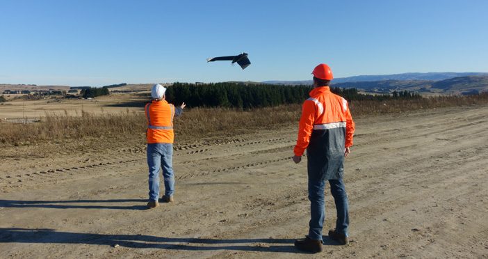
We sat down with Jordan Whyte, Senior Mine Surveyor at Oceana Gold, to find out how their Surveyors are using drone technology and why they chose the eBee X Survey Drone.
GS: Can you give us an overview of the Macraes Operation?
Jordan: The Macraes Gold Mine site in New… Read More
Case Study: Our Scan to BIM Journey
Categories:
Tags:
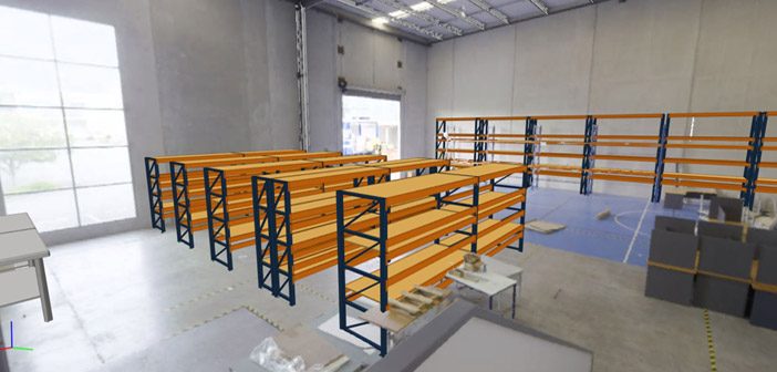
Our Auckland office recently moved to a new building to give us the extra space we needed as the company continues to grow. This move offered a unique opportunity for us to practice what we preach and put our digital solutions to work!
Although our office move was only 500m… Read More
Standing Out | A JCB Hydradig & engcon Tiltrotator Powerful Combination
Categories:
Tags:
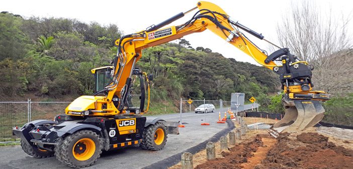
We caught up with Ian Holmes from IH Earthworks to check out the shiny new addition to his fleet—a wheeled 11-tonne JCB Hydradig with the addition of an engcon tiltrotator
Ian told us he chose this set up after a lot of research. He had quite a range of machinery… Read More
Central Interceptor Project | Inspecting Surfaces with the New Leica MS60
Categories:
Tags:
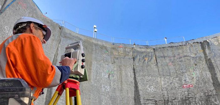
The Watercare Central Interceptor Project in Auckland has reached an exciting stage as the team prepare for the arrival of Hiwa-i-te-Rangi their giant new Tunnel Boring Machine [TBM] which is currently being built in Germany.
The main contractor Ghella Abergeldie Joint Venture are building the Central Interceptor over six years… Read More
Sub-Millimetre Accuracy with Leica Absolute Laser Trackers
Categories:
Tags:
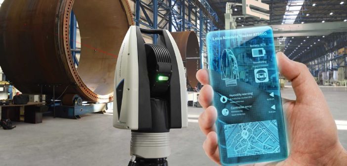
A long-term standard in Industrial Metrology, Leica Absolute Laser Trackers lead the field in terms of the accuracy, reliability and durability of portable coordinate measuring machines.
Surveyors would recognise these machines as Total Stations, but with the distinction of being capable of measuring large objects to sub millimetre accuracy. Leica… Read More
Public Safety in the age of Reality Capture [Webinar]
Categories:
Tags:

Discover how to leverage the latest advancements in reality capture technology in this webinar from Leica Geosystems: “Public Safety in the age of Reality Capture”
As police and security departments around the world have rapidly added reality capture technology to their scene recording tool-set, Leica has continued to innovate to… Read More
Digitally Preserving NZ’s Maritime History with the Leica RTC360
Categories:
Tags:
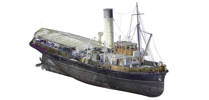
When you are involved in laser scanning you see the world differently. We get excited about unusual and interesting structures and often think “That would be amazing to scan!”.
Few structures are more complex or intricate than maritime vessels, so when Lennon Bedford & Richard Harrison from our Christchurch team… Read More
Vitruvius utilise Leica Laser Scanning Technology for Northland’s Rail Upgrade
Categories:
Tags:
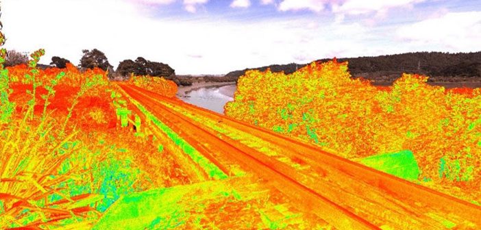
Upgrading Northland’s Rail Network
The first section of track on the historic North Auckland Line (NAL) was opened in 1868 and the line was finally completed in full in 1925. NAL begins at Westfield in Auckland and runs for over 280km before terminating at Otiria in Northland.
With many NAL… Read More
Challenge Accepted: Testing the Leica GS18I Visual Positioning Technology
Categories:
Tags:
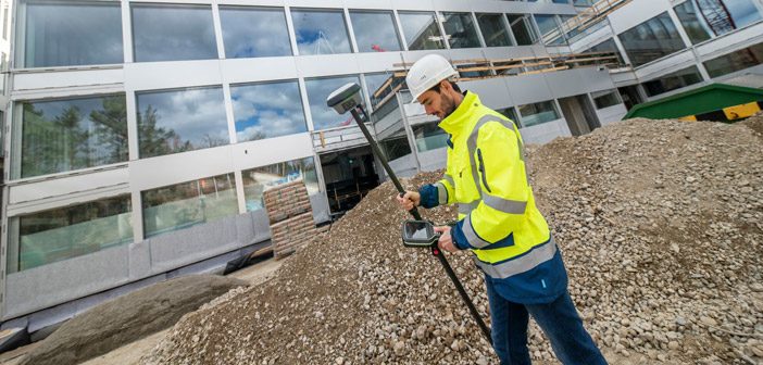
As part of our own internal training we decided to set our Survey Team a challenge:
Measure a stockpile with the new Leica GS18I GNSS, first with the tilt pole and then with imagery using the GS18I’s innovative new Visual Positioning technology. Record the time it took to take the… Read More
Mexteds Deliver Surface Perfection at Basin Reserve
Categories:
Tags:
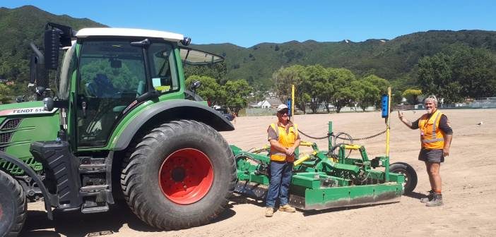
The iconic Wellington Basin Reserve is well known as the home of New Zealand Cricket and admired for its rich history and superior playing conditions. Dating back to 1840 this historic venue has hosted many world-class events including the recent Black Caps test match victory against India.
Keeping the ground… Read More