Leica Robotic Total Stations Comparison Chart
Categories:
Tags:
Keen to know where the new model Leica Nova MS60 Multistation fits into the Leica Geosystems line up of Robotic Total Stations?
See all the most important specifications at a glance in this handy comparison chart.
Leica Robotic Total Stations:
Specifications
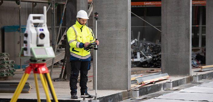
Leica TS13
Leica Viva TS16
Leica Nova TS60
Leica… Read More
Leica ULTRA | The Ultimate Utility Tracing System
Categories:
Tags:
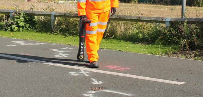
The Leica ULTRA Utility Tracing System delivers accurate and reliable information to protect buried assets and accurately map their location in order to plan for excavation activity.
As development of infrastructure in New Zealand has progressed, our network of underground pipes and cables has also expanded and become more complicated.… Read More
Leica BLK3D: Ultimate Onsite Documentation & Collaboration [Webinar]
Categories:
Tags:
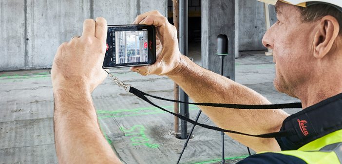
The Leica BLK3D captures images and 3D measurements from 2D photographs using stereo photogrammetry and edge computing, which can then be shared in multiple formats.
This webinar will show you how to use the BLK3D for ultimate onsite documentation and collaboration in conjunction with the Leica RTC360 and Leica BLK360.… Read More
Ground Penetrating Radar Made Easy | Leica DSX Utility Detection System
Categories:
Tags:
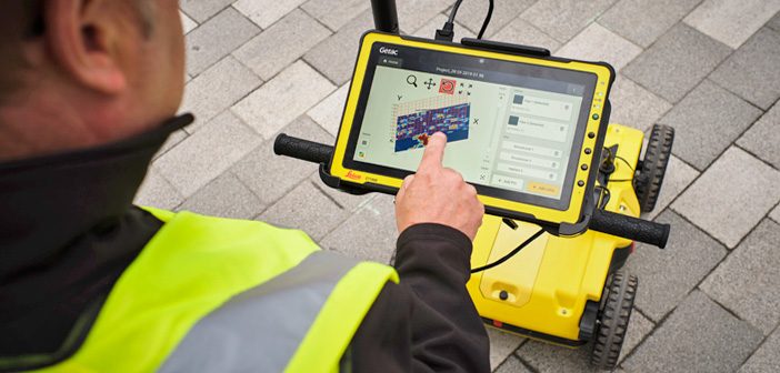
Introducing the Leica DSX – an all in one utility detection system designed for non-experienced and first time ground penetrating radar [GPR] users.
It is a highly advanced yet easy-to-use solution for locating and mapping buried utilities in a safe, fast and reliable way, without the costs of hiring a… Read More
Embracing Digital Layout with Leica iCON iCR70
Categories:
Tags:

The Leica iCON iCR70 is a construction robotic total station designed to accelerate construction processes onsite and enable you to achieve more in a day.
With a bullet-proof set up routine, it provides maximum digital layout efficiency with flexible handling of fully rendered 3D design models in the field.
The… Read More
Concrete Scanning for Real-Time Data Analysis Onsite
Categories:
Tags:
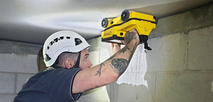
Seeing Through Concrete Structures
How can contractors know what lays behind a concrete wall, ceiling or floor? Concrete scanning reveals what’s buried in concrete and is a crucial step in building and construction engineering projects. Knowing the locations of obstacles such as rebars, voids, post-tension cables, cavities, and conduits allows… Read More
WEBINAR: Speed and Collaboration with the BLK2GO
Categories:
Tags:
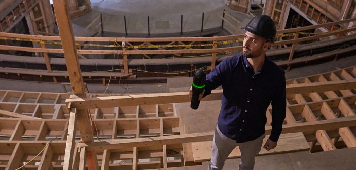
The latest handheld laser scanner, Leica BLK2GO, allows users to seamlessly capture complex spaces in 3D while moving, in real time using SLAM spatial awareness technology. It automatically builds 3D point clouds as you move throughout the entire scan session, which can then be used to join multiple scans, be… Read More
Transform Your Digital Delivery | NEW Leica Nova MS60 MultiStation
Categories:
Tags:

The all NEW Leica Nova MS60 Multistation has arrived! The new model takes the Leica MS60 to the next level with the addition of several new features which transform this MultiStation into the ultimate all-rounder automatically and continuously adapting to any environment regardless of the challenges.
The New Leica Nova… Read More
Designed for Flexibility | Leica Rugby Upgradable Lasers
Categories:
Tags:
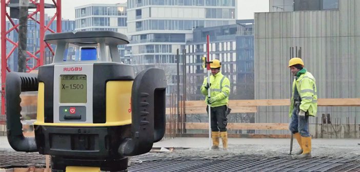
The revolutionary and unique design of the Leica Rugby Upgradable Lasers enables users to gain maximum performance and functionality without the need to purchase a separate model in the future.
Leica Rugby Upgradable Lasers are also designed for superior durability, ease of use, and rugged performance on construction sites.
Designed… Read More
eBee X Survey Drone: Maximise Your Aerial Mapping Efficiency
Categories:
Tags:
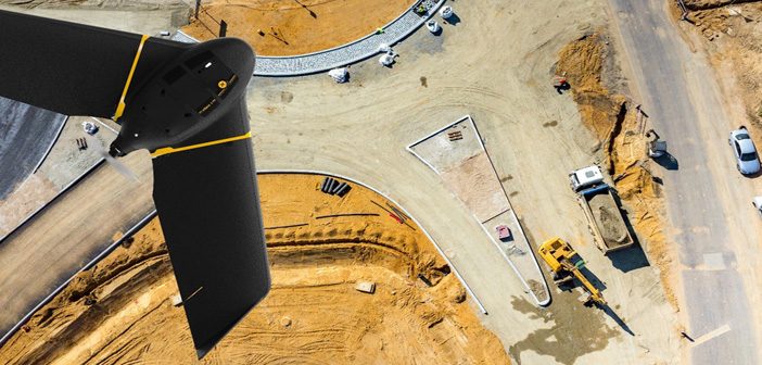
The senseFly eBee X survey drone should be added to every aerial surveyor’s toolkit! Its fixed-wing design with high spec features provide an all-in-one solution to everyday aerial surveying needs. It is designed to deliver maximum efficiency by addressing common issues such as time constraints, weather predicaments and safer access… Read More