KiwiRail Survey Kaikoura’s Main North Line
Categories:
Tags:
Recovering from the 7.8 magnitude Kaikoura earthquake of November 2016 has been a long time coming for those effected. Along with widespread devastation of homes and businesses in the region, the earthquake also ripped through the main transport routes that linked Kaikoura to Picton and Christchurch, closing SH1 and pushing… Read More
Public Safety: How to Clear Scenes Faster with Laser Scanning [Webinar]
Categories:
Tags:
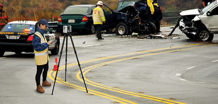
3D laser scanning is a proven way to document crime and crash scenes. With a push of a button, you can “freeze” the scene in time with millions of high-accuracy points and panoramic photography.
The resulting data is a true color, extremely detailed, rich, vivid and immersive 3D environment that… Read More
Lava Cave Mapping with the Leica BLK360
Categories:
Tags:

The landscape of Auckland has been primarily shaped by historic volcanic activity. A sprawling city located in an isthmus, home to a network of over 50 dormant and extinct volcanoes. Numerous above ground volcanic cones are prominent features of the city’s skyline, but what many residents don’t realise is that… Read More
Envivo impressed with Leica RTC360 laser scanner
Categories:
Tags:
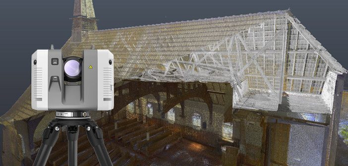
It turned out to be a blessing in disguise when Envivo’s old laser scanner was damaged and needed replacing. What at first seemed like a disaster, quickly turned into a fortunate series of events.
Fortunately for them, there have been vast improvements in laser scanning technology over the last couple… Read More
Leica RTC360 – VIS technology and Live Position function
Categories:
Tags:
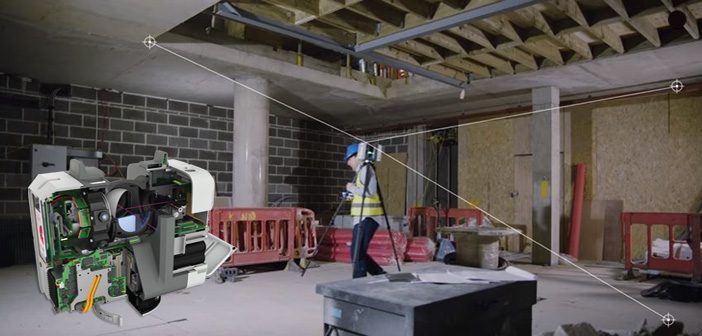
With the Leica RTC360 laser scanner, you’ll find that delivering precise data is easier and quicker than ever before. With lightning fast point cloud and HDR image capture at 2 million points per second, the RTC360 offers unparalleled scanning productivity.
Let the innovative VIS Technology guide you from one setup… Read More
University of Waikato | Mapping Tauranga Harbour Seabed
Categories:
Tags:
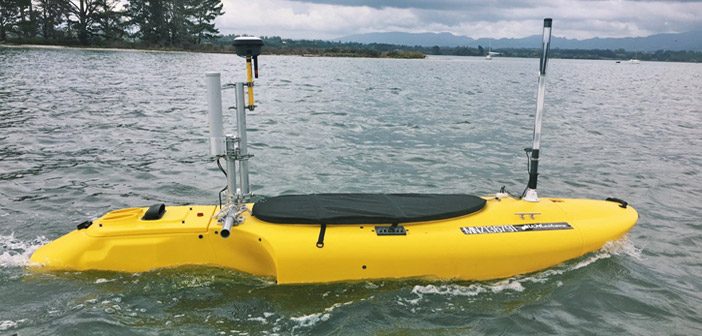
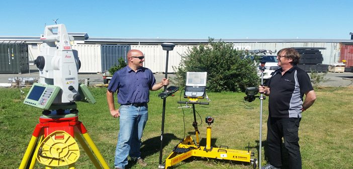
We caught up with the University of Waikato to see how they’re utilising their fleet of Leica GNSS purchased last year, especially the new Leica GS18 T GNSS antenna.
We spoke to Dean Sandwell, Technician from the School of Science who has been setting up the equipment for student research… Read More
SmartFix joins LINZ Geodetic database
Categories:
Tags:
Great news for SmartFix users especially Cadastral surveyors. Over 90% of our SmartFix sites are now part of the LINZ Geodetic database.
Almost all of our sites are 3rd order stations, with another 4 sites at 12th order. The 12th order sites will be upgraded to 3rd order in the… Read More
3 Ways Leica BLK360 Improved Workflow
Categories:
Tags:

Leica BLK360 International Series #2: 3 ways Leica BLK360 improved workflow
Stephen Gross, an Architectural Engineer at Valley Home Improvement in Northampton, Massachusetts, has had his Leica BLK360 since August of 2017. He recently shared with us how using the BLK360 has improved his workflow.
#1: Site Visit Changes
Before… Read More
Are you ready for GPS week rollover?
Categories:
Tags:

Leica Geosystems is constantly working on software advancements to improve performance from the latest GNSS signals in order to increase user experience, productivity and compatibility. These improvements are passed onto Leica users as software upgrades for our latest GNSS products and also as updates to manage any major signal changes… Read More
HxGN LIVE 2019 | Shaping Smart Change
Categories:
Tags:

It’s nearly time for HxGN Live 2019! If you haven’t been before, HxGN Live is the Leica Geosystem premier conference and it is big, really big.
This four-day, annual event in Las Vegas welcomes thousands of professionals from around the world, who join together to experience the digital solutions of… Read More