Stream C – Next Level Ground Penetrating Radar
Categories:
Tags:
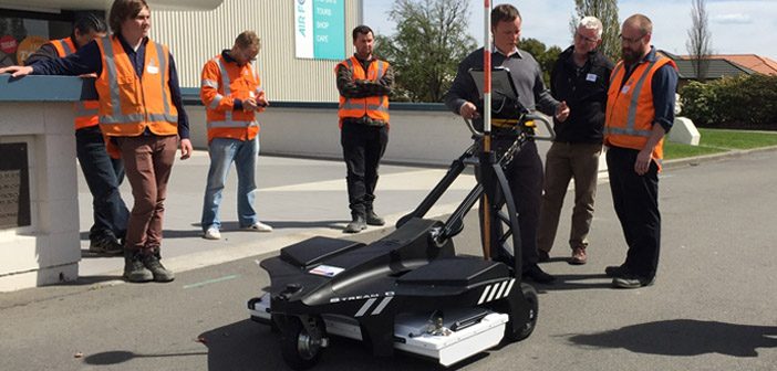
Stream C is a compact array solution for real-time 3D mapping of underground utilities and features. Thanks to increased levels of accuracy provided by a massive antenna array, Stream C Ground Penetrating Radar is able to automatically detect pipes and cables.
Stream C Ground Penetrating Radar (GPR) detects underground utilities… Read More
Leica BLK3D: In-Picture Measurements with Optimum Accuracy
Categories:
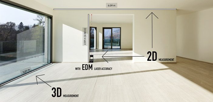
The new Leica BLK3D creates images that contain precise three-dimensional measurements. Understanding how measurements are calculated will ensure you’re getting the best results from your Leica BLK3D.
In this article we aim to explain how to create in-picture 3D measurements with optimum accuracy and go through some of the considerations… Read More
Discover the C-thrue Concrete Scanner
Categories:
Tags:
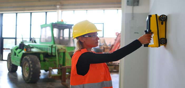
The C-thrue concrete scanner enables you to see through concrete structures and view real-time scan data onsite.
Knowing what lies behind concrete before cutting or drilling improves safety and safeguards against the risk of damage. The C-thrue concrete scanner easily locates rebars, voids, post-tension cables, cavities, conduits and any other… Read More
KiwiRail Survey Kaikoura’s Main North Line
Categories:
Tags:
Recovering from the 7.8 magnitude Kaikoura earthquake of November 2016 has been a long time coming for those effected. Along with widespread devastation of homes and businesses in the region, the earthquake also ripped through the main transport routes that linked Kaikoura to Picton and Christchurch, closing SH1 and pushing… Read More
Public Safety: How to Clear Scenes Faster with Laser Scanning [Webinar]
Categories:
Tags:
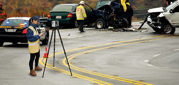
3D laser scanning is a proven way to document crime and crash scenes. With a push of a button, you can “freeze” the scene in time with millions of high-accuracy points and panoramic photography.
The resulting data is a true color, extremely detailed, rich, vivid and immersive 3D environment that… Read More
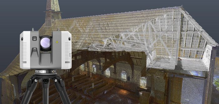
Lava Cave Mapping with the Leica BLK360
Categories:
Tags:

The landscape of Auckland has been primarily shaped by historic volcanic activity. A sprawling city located in an isthmus, home to a network of over 50 dormant and extinct volcanoes. Numerous above ground volcanic cones are prominent features of the city’s skyline, but what many residents don’t realise is that… Read More
Envivo impressed with Leica RTC360 laser scanner
Categories:
Tags:
It turned out to be a blessing in disguise when Envivo’s old laser scanner was damaged and needed replacing. What at first seemed like a disaster, quickly turned into a fortunate series of events.
Fortunately for them, there have been vast improvements in laser scanning technology over the last couple… Read More
Leica RTC360 – VIS technology and Live Position function
Categories:
Tags:
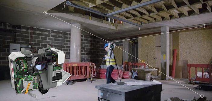
With the Leica RTC360 laser scanner, you’ll find that delivering precise data is easier and quicker than ever before. With lightning fast point cloud and HDR image capture at 2 million points per second, the RTC360 offers unparalleled scanning productivity.
Let the innovative VIS Technology guide you from one setup… Read More
University of Waikato | Mapping Tauranga Harbour Seabed
Categories:
Tags:
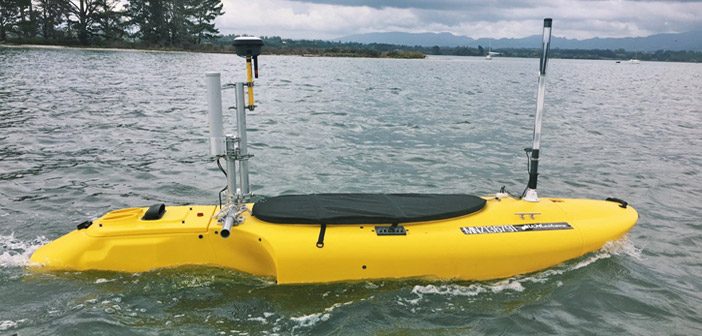
We caught up with the University of Waikato to see how they’re utilising their fleet of Leica GNSS purchased last year, especially the new Leica GS18 T GNSS antenna.
We spoke to Dean Sandwell, Technician from the School of Science who has been setting up the equipment for student research… Read More
SmartFix joins LINZ Geodetic database
Categories:
Tags:
Great news for SmartFix users especially Cadastral surveyors. Over 90% of our SmartFix sites are now part of the LINZ Geodetic database.
Almost all of our sites are 3rd order stations, with another 4 sites at 12th order. The 12th order sites will be upgraded to 3rd order in the… Read More