
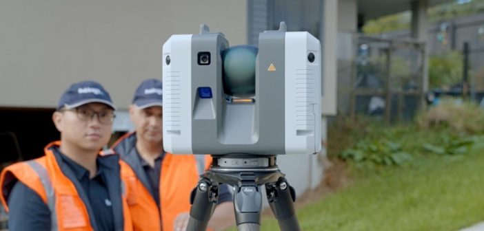
We join the Babbage survey team onsite to discover how they’re using Leica laser scanning technology to complete over 200 condition surveys of buildings located alongside the new O Mahurangi – Penlink transport link in Auckland.
On this project, it was important for the Babbage team to ensure that they met the wider goals of their client, O Mahurangi Alliance, by minimising their impact on the environment and stakeholders.
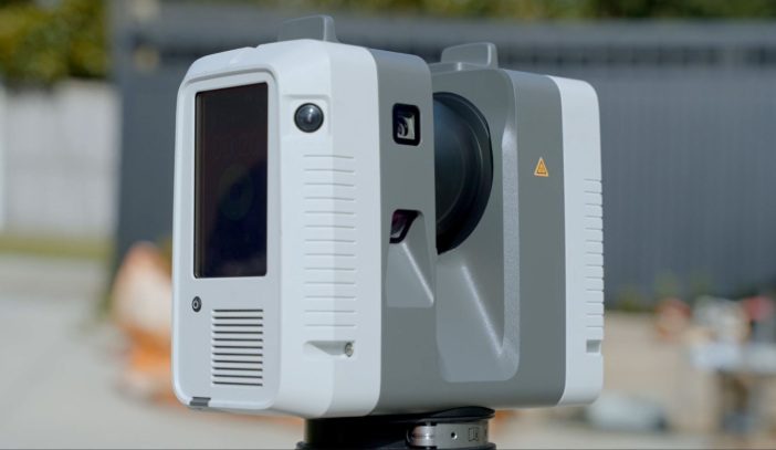
By using the Leica RTC360 laser scanner they were able to achieve those goals by minimising disruption to residents and capturing a digital record of the condition of the properties in a fast and efficient way.
 |
“3D laser scanning is a less intrusive method that enables us to conduct this significant undertaking of surveying over 200 residential and commercial properties very efficiently. It meant we needed to only spend 15 minutes at each property and could come away with all the data captured. As a Surveyor, the things I like about the RTC360 are that it’s light, easy to set up, it captures 2 million points per second and provides comprehensive data capture for us”.
Farzad Faraji – Surveyor, Babbage |
Laser scanning as an extension of traditional survey workflow
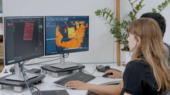
On the O Mahurangi – Penlink project, Babbage are using their Leica RTC360 as an extension of their traditional survey workflow. They are collecting traditional survey coordinates from known points on the ground and then combining that with their scanning data.
The data is then brought into Leica Cyclone Register 360 where they combine the coordinates together with the laser scanning data. From there, it can be exported into different programs for the extraction of topographical survey information into CAD and solid model formats.
| “What we find through partnering with our clients is that the scanning technology changes the way they approach a project. One of the exciting tools that Babbage have been using is the autoclassification feature that we have in Leica Cyclone 3DR, its a great way to organise and separate out the different layers of information within the point cloud, so that they can more effectively use it for their deliverables”.
Kirsty Mackie – Reality Capture Specialist, Global Survey |
 |
O Mahurangi – Penlink: A vital new transport link for Auckland
The O Mahurangi – Penlink project has a long history dating back to the 1980s, when an alternative transport link to the Whangaparāoa Peninsula was first identified. It includes construction of a new 7km road between the Whangaparāoa Peninsula and SH1 at Redvale, with a new 535m bridge crossing over the Wēiti River.
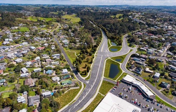
(Image: Latest design visual of the intersection of Penlink and Whangaparāoa Rd)
In June 2022, the O Mahurangi Alliance was formed between HEB, Fulton Hogan, Aurecon and Tonkin + Taylor, and in conjunction with Waka Kotahi NZ Transport Agency to deliver the project. With a completion date of late 2026, this $830 million project is an important part of the region’s infrastructure development plan and supports urban growth in north Auckland.
Embracing technology to deliver more for clients
Babbage Consultants are multi-disciplinary practice, with a high level of technical expertise. They embrace innovation and technology to deliver tailored solutions for their clients that are practical, commercially sound and focused on sustainable principles.
Building strong partnerships with clients is the key to ensuring project success, and a focus on efficiency and accuracy maintains the high quality of project deliverables.
Collaboration is at the heart of how they operate, in this case the Building Surveying Team and the Land Surveying Team collaborated to provide the pre-condition reports, with the digital scan providing a permanent record for the reporting on the project.
When looking for laser scanning solutions, the Babbage team chose the RTC360 because they believe it strikes the right balance between speed and accuracy of the output.
 |
“We chose the Leica RTC360 because it’s a stand out solution across the board. Amazingly fast data capture, automated registration in the field, easy to transport and a field to finish workflow that’s seamless. On top of that the HDR 360 images enable us to add rgb values to our scans as well as providing a photo documentation of the site.
The Global Survey reality capture team are the icing on the cake, responsive technical support, and training when the team needs it. We can’t ask for better than that”. Graham Petrie – Survey Manager, Babbage |
Visit the Babbage website to read more on their capabilities and projects.
Contact the Global Survey team for further information on Leica reality capture solutions.
SHARE THIS ARTICLE