Leica Cyclone 3DR is a seamless extension of the Cyclone product family which works hand in hand to take users from field data collection with Cyclone FIELD 360 through registration in Cyclone REGISTER 360 and deliverable creation in Cyclone 3DR.
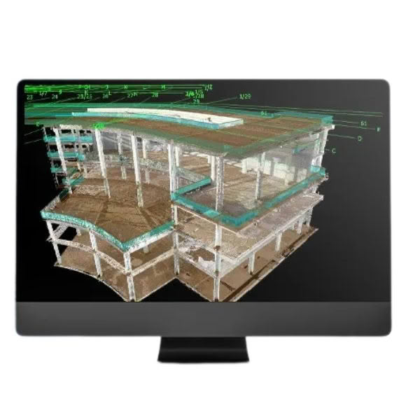
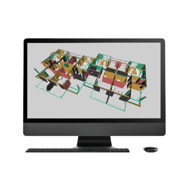
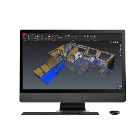
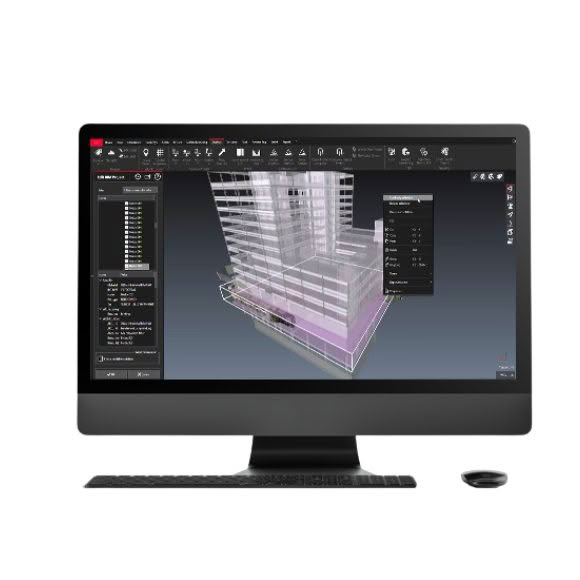
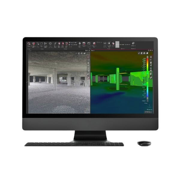
Cyclone 3DR fuses Leica JetStream technology for centralised, full-scale point cloud management with automated point cloud analysis and modelling into one simple workflow-based software with tailored tools for the surveying, construction and inspection fields. Where most software will focus on a single workflow to create a specialised deliverable, Cyclone 3DR includes a range of adaptable tools for inspection and meshing that can be leveraged to create an assortment of 3D deliverables and reports.
Based upon the simple design of the next-generation Cyclone family, Cyclone 3DR allows both new and experienced users to move from import through analysis and publishing intuitively and simply. By automating common tasks, customers can reduce unexpected project delays and quickly deliver actionable information to clients.
Key benefits:
- Sensor agnostic projects powered by JetStream or industry-standard exchange formats
- Fast, light and flexible meshing tools
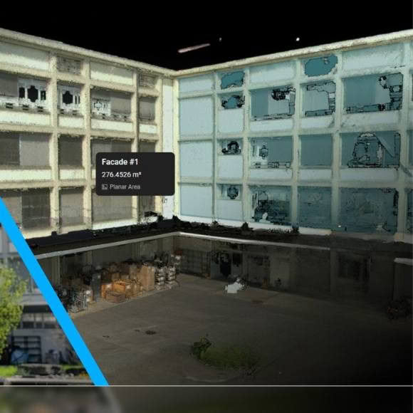
- Inspection and measurement for design-in-context
- Domain-centric workflows for AEC, Survey and Tank Inspection
- Advanced customisation through a rich scripting engine
- Reporting that conforms to industry standards (e.g., Tank Inspection to API 650/653)
- Robust QA operations
- Full interoperability with common design formats, including IFC and Revit model files
- Automatic feature extraction
- DSM/DTM creation
- Contour extraction and much more
The Cyclone family of products is a key part of the complete solution. The various Cyclone modules take users from start to finish for every type of point cloud project.
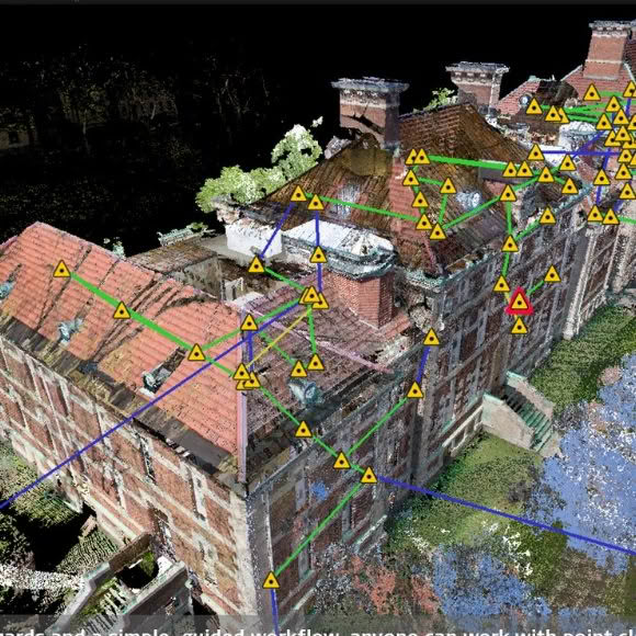
There are modules to take advantage of the unique Leica Geosystems laser scanners field data collection operations, such as traverse, back-sight and resection for rich survey-grade collection and registration of data. This includes wizard-like automation routines that do all the work for the user as well as the industries richest set of QA/QC and survey adjustment and analysis tools.
There are other modules dedicated to generating a vast array of deliverables from reports to maps and 3D models, movies/animations, and light weight 3D data formats that can be distributed freely over the web. These modules support a wide range of industries and workflows including civil engineering, as-built 3D models, topographic surveys, BIM models and much more.
Leica Cyclone is comprised of individual software modules for different needs and for flexible product deployment:
- Leica Cyclone REGISTER
- Leica Cyclone REGISTER 360
- Leica Cyclone BASIC
- Leica Cyclone SURVEY
- Leica Cyclone MODEL
- Leica Cyclone IMPORTER
- Leica Cyclone SERVER
- Leica Cyclone TruView PUBLISHER
- Leica Cyclone II TOPO