Introducing the New Leica BLK360 SE Laser Scanner and PinPoint Software!
Categories:
Tags:
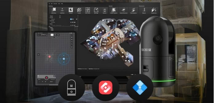
Precision, simplicity and affordability converge in Leica’s latest laser scanning release — the BLK360 SE!
Designed to provide fast, accurate and highly portable scanning capabilities, the Leica BLK360 SE is designed to enhance workflows in architecture, construction, engineering and beyond. When paired with PinPoint software, users unlock a streamlined, powerful… Read More
ARCH NZ Conference panel discussion: Is New Zealand ready for the digital age?
Categories:
Tags:
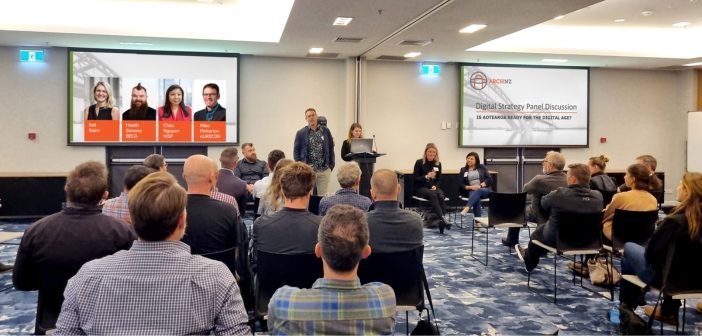
Is New Zealand ready for the digital age?
This was the theme of the panel discussion that closed out the 2024 ARCH NZ conference. Autonomy & Reality Capture Hub NZ (ARCH NZ) is a user group for professionals working in the AEC industry in New Zealand. The inaugural annual user… Read More
Laser scanning’s growing use in visual effects and gaming
Categories:

Did you know that AEC professionals use the same tools for as-builting as visual effects artists use for movies and games?
Reality capture excels not only in documenting real-world environments, but also in crafting immersive settings for games and movies. In the architecture, engineering, and construction (AEC) industry, precision and… Read More
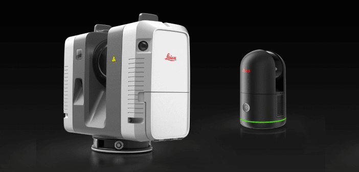
Discover the new and improved Leica BLK360!
Categories:

The new Leica BLK360 has the same bones as the original BLK360, but a completely different constitution!
In this article we discuss the key differences between the first generation original model and the new and improved Leica BLK360.
The newly released Leica BLK360 represents a full circle in the Leica… Read More
Optimise your in-field registration workflow with Leica Cyclone FIELD 360
Categories:

The acquisition of high-quality 3D scan data is the foundation of laser scanning. Utilising robust laser scanning software, such as Leica Cyclone FIELD 360, empowers users to capture accurate data, facilitating the immediate creation of deliverables. One specific functionality that plays a pivotal role in this process is in-field registration.… Read More
Laser scanner comparison: Leica RTC360 vs Leica BLK360
Categories:
As construction projects become larger and more complex, it is crucial to have the right tools to ensure efficient and accurate work. Two laser scanners, the Leica RTC360 and the next-generation Leica BLK360, are popular choices among building construction professionals.
At first glance, the obvious differences between the two scanners… Read More
Babbage: Leica RTC360 delivering maximum scanning efficiency on the O Mahurangi – Penlink project
Categories:
Tags:

We join the Babbage survey team onsite to discover how they’re using Leica laser scanning technology to complete over 200 condition surveys of buildings located alongside the new O Mahurangi – Penlink transport link in Auckland.
On this project, it was important for the Babbage team to ensure that… Read More
Harrison Grierson: Bringing projects to life with the Leica BLK2GO
Categories:
Tags:
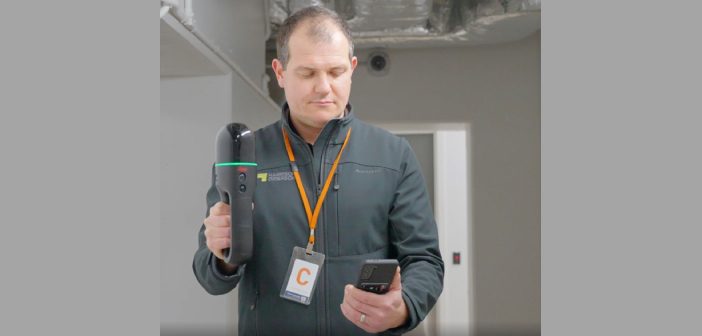
On a crisp Wellington morning, we joined the Harrison Grierson survey team onsite at the Bowen Campus buildings adjacent to Parliament Grounds in Wellington.
This large construction project spans a 1 hectare site comprising of four commercial office towers that will house approximately three and a half thousand workers when… Read More
Introducing the CHC AlphaAir 450 LiDAR: Smaller, lighter sensor for Drone Surveying
Categories:
Tags:
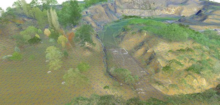
3D terrain mapping with drones has become common practice over the last decade. Relatively low-cost drones combined with autonomous mission planning apps and user-friendly photogrammetry software (such as ContextCapture and Leica Infinity amongst others) have provided highly efficient workflows for building accurate and complete 3D models of terrain more quickly… Read More
McLeod Cranes: Cleaning up the Waikato Te Awa river with the Leica RTC360
Categories:
Tags:
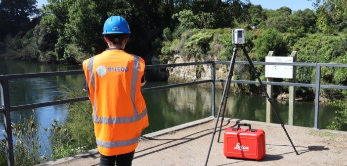
Did you know there are approximately 200 cars on the bottom of the Waikato Te Awa River? The Leica RTC360, a 230 tonne crane and bathymetric sonar have all been key elements in the cleanup efforts of this debris.
It’s a picture perfect autumn day in the Waikato as we… Read More