Leica Captivate surveying equipment – How to handle the 3G shutdown
Categories:
Tags:

In New Zealand, all the major telco providers have indicated that they will be shutting down the 3G cellular network to free up low-band spectrum to extend 5G service in rural areas. One NZ (formally Vodafone), Spark and 2 Degrees will be ending their service soon starting from end of… Read More
Patersons Dunedin: Transforming Coastal Monitoring with the Apache4 Hydrographic Survey Boat
Categories:
Tags:
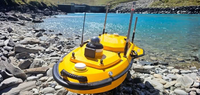
In our latest article, we caught up with the team at Patersons Dunedin office who have been putting the CHCNAV Apache4 hydrographic surveying boat to the test on a long-term coastal monitoring project along the Otago Peninsula.
The Challenges of Monitoring Coastal Change
The project focuses on tracking sand movement… Read More
Introducing the New Leica BLK360 SE Laser Scanner and PinPoint Software!
Categories:
Tags:
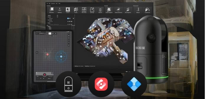
Precision, simplicity and affordability converge in Leica’s latest laser scanning release — the BLK360 SE!
Designed to provide fast, accurate and highly portable scanning capabilities, the Leica BLK360 SE is designed to enhance workflows in architecture, construction, engineering and beyond. When paired with PinPoint software, users unlock a streamlined, powerful… Read More
CHCNAV Apache 3 Pro: Addressing the Challenges at Whanganui Port with Hydrographic Surveying
Categories:
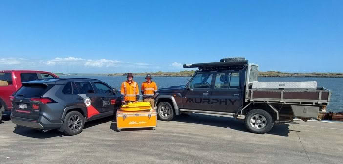
Whanganui Port Project Overview
Whanganui Port has long served as a crucial hub for both commercial and recreational maritime activities. However, recent challenges highlight the need for significant upgrades and improvements to ensure the port’s continued functionality and safety. This article outlines the challenges faced by Whanganui Port, and why… Read More
Unlocking GNSS efficiency in challenging environments with Leica multi-frequency solutions
Categories:

Selecting the right technology for a project is often dictated by accuracy requirements, with GNSS and Total Station being common choices. However, certain projects require the convenience and speed of GNSS, despite challenges like high multipath or dense overhead canopy.
Traversing through thick bush with limited line of sight can… Read More
C&R Surveying – Efficiency gains with the Leica AP20 AutoPole
Categories:
Tags:
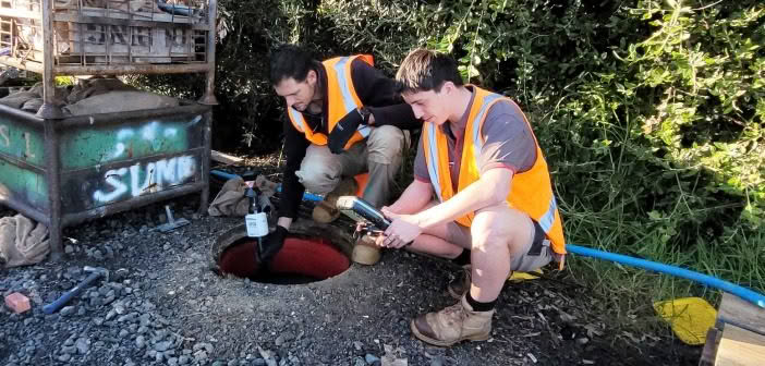
We went onsite with C&R Surveyors to see how they are utilising the Leica AP20 AutoPole on a construction project in Orewa. Jordan Zagonel, Surveyor and Gray Robinson, surveying student at Otago were tasked with surveying the site to provide stakeholders with heights, positions and details of buildings and objects.… Read More
Kurloo Monitoring: Testing in New Zealand environments
Categories:
Tags:
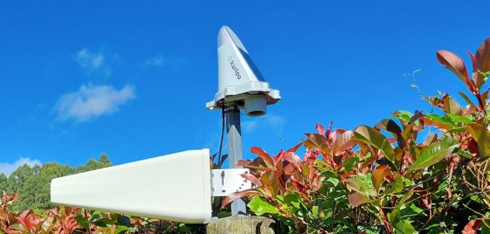
The Kurloo monitoring solution for displacement and slope monitoring is a two-part system. The first part is the Kurloo device, which is mounted on the site you want to monitor. This device gathers precise data remotely using its on-board GNSS components and environmental sensors. Even small movements can be detected… Read More
ARCH NZ Conference panel discussion: Is New Zealand ready for the digital age?
Categories:
Tags:
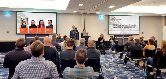
Is New Zealand ready for the digital age?
This was the theme of the panel discussion that closed out the 2024 ARCH NZ conference. Autonomy & Reality Capture Hub NZ (ARCH NZ) is a user group for professionals working in the AEC industry in New Zealand. The inaugural annual user… Read More
Laser scanning’s growing use in visual effects and gaming
Categories:
Tags:

Did you know that AEC professionals use the same tools for as-builting as visual effects artists use for movies and games?
Reality capture excels not only in documenting real-world environments, but also in crafting immersive settings for games and movies. In the architecture, engineering, and construction (AEC) industry, precision and… Read More
Kurloo spreads its wings into New Zealand!
Categories:
Tags:

We’re pleased to announce that Global Survey have been named as the exclusive distribution partner for Kurloo monitoring solutions in New Zealand.
“Kurloo is a brilliantly simple monitoring technology that leverages the power of GNSS to make autonomous and remote monitoring more widely accessible. Our team are excited about being… Read More