
The Leica GPR solution provides roading, earthworks, concrete contractors and council developers/asset managers the ability to quickly analyse underground objects across large areas. Risks can then be identified and minimised before earthworks begin, greatly improving safety onsite.
The advantage of using Leica GPR is the ability to quickly see a full picture of what’s going on underground. Ground Penetrating Radar enables you to locate underground objects including non-conductive pipes and fibre optics. The limitation of other detection tools, such as cable locators, is they can only detect metalic or conductive objects.
Specifically designed to operate on all terrains especially construction sites, the Leica GPR’s rugged housing and ergonomic design mean it is easy to use. Leica GPR can see beneath asphelt, concrete, soil, sand, grass, gravel and almost all surface types.
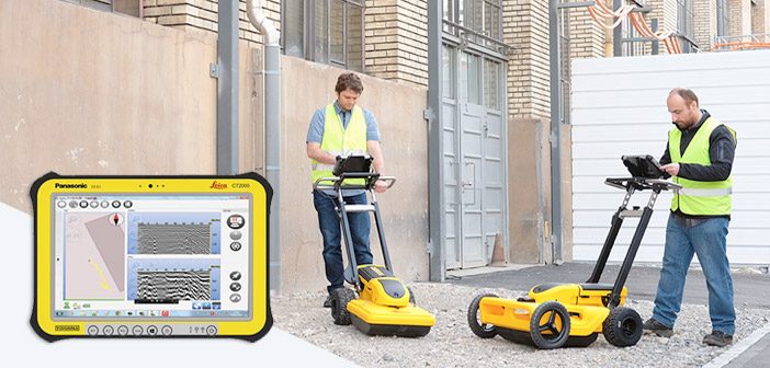
Leica GPR provides a complete picture of what’s going on underground including location, depth and dimensions of objects. The on-board tablet provides a real-time visual indication of underground objects, ground layers and densities.
With Leica GPR data collection and analysis can be completed onsite. The collected data is stored on the rugged tablet with on-board software tools for onsite verification and analysis. The software is simple and intuitive, enabling you to easily process, store and export the data collected.
In the field you can see a graphic visualisation of the data, tag positions with unique markers and use the grid overlay tool to determine the distance between swaths. There is also the option to overlay google maps in satellite or road view [wifi dependent].
Data can be exported via USB in multiple formats compatible with industry standards and CAD software.
There is also the option to add RTK GPS for precision positioning and mapping applications.
To demo the Leica GPR contact us on 0800 453 422 or email info@globalsurvey.co.nz
SHARE THIS ARTICLE