We caught up with the University of Waikato to see how they’re utilising their fleet of Leica GNSS purchased last year, especially the new Leica GS18 T GNSS antenna.
We spoke to Dean Sandwell, Technician from the School of Science who has been setting up the equipment for student research projects.
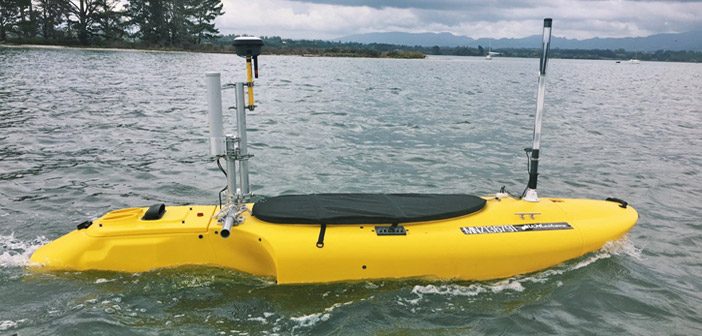
One of their most interesting projects involves mapping Tauranga harbour seabed using their autonomous jet powered kayak. The kayak is nick-named Whaitere [Stingray] for it’s ability to scan and map the bottom of the seabed in the same way Stingrays hunt for prey.
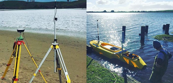
Positioning data is accurately collected with a Leica GS18 T GNSS antenna mounted on the kayak with a Leica GS16 base station on shore. The Leica CS20 controller is used as an onboard datalogger for RTK and echo-sounder logging.
Mapping Tauranga Harbour Seabed
Masters of Science research student, Morgan Harvie and supervisor Julia Mullarney, are using the autonomous jet powered kayak with Leica GNSS set up to examine flows across different benthic environments such as sandflats and seagrass.
The challenge of mapping in tidal areas is the ever changing depth of water over time. Another factor is the constant motion of the kayak which means that the GNSS antenna is rarely directly above the echosounder.
The Leica GS18 T combines the latest GNSS technology with an IMU [inertial measurement unit] that uniquely measures tilt and direction in real-time. By applying this tilt technology, the GNSS antenna no longer needs to be vertical which makes the GS18 T ideal for this project where the kayak is always in motion.
The autonomous kayak is also equipped with a side scan sonar and ADCP (acoustic doppler current profiler) to complete the mapping of the seabed.
The positioning and echo-sounder data is logged directly on the Leica CS20 controller, which is exported using a custom style sheet loaded on Leica Captivate. Using Leica Captivate simulator on a PC back in the office allows for large files to be exported. The custom style sheet allows export of one file with timestamp, RTK positional data, GS18T tilt information and echo-sounder data. This allows the research team to align ADCP current data timestamps and filter out data based on tilt data.
This enables research students to analyse the data further and determine which data relates to the kayak moving from waves or during turning so it can be filtered from the results.
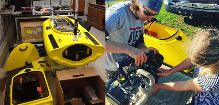
The kayak is designed and produced by Integrated Coastal Solutions in the USA. The University of Waikato has the only one of its kind in New Zealand and are hopeful to complete the Maritime NZ safety case and certification by mid 2019 and have more time to further develop the monitoring capabilities of the vessel.
Find out more about the School of Science at University of Waikato
Follow Coastal Marine Group on Instagram
SHARE THIS ARTICLE