
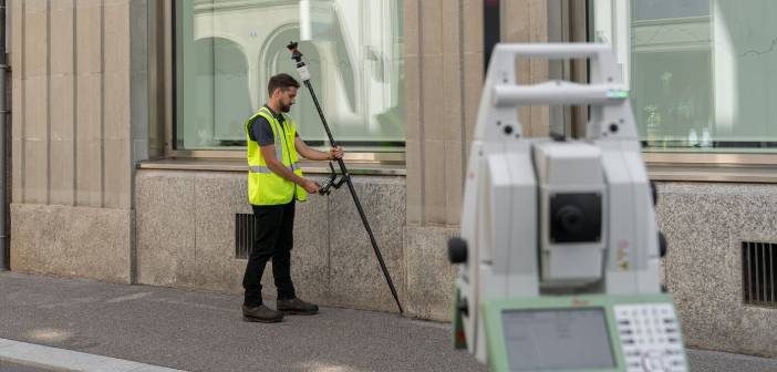
The new AP20 AutoPole is the latest innovation from Leica Geosystems and the world’s first tilt pole for Total Stations!
Leica Robotic Total Stations and MultiStations are a crucial part of everyday survey workflows, relied on by Surveyors around the world for accurate and efficient measuring and layout tasks.
The new AP20 AutoPole is the next evolution of the Leica Captivate system with an integrated IMU (Inertial Measurement Unit). An IMU is an attitude sensor made up of various sub-sensors, which capture data about movement, ultimately allowing the tilt of the pole to be determined.
The IMU was designed by Leica Geosystems specifically for surveying applications during the development of the Leica GS18T Smart Antenna. The Leica GS18T story tells the tale of an almost decade long quest for reliable tilt compensation, that was also calibration free and immune to magnetic disturbance.
The Leica GS18T, introduced in 2019, was the first sensor to use this unique Tilt technology, before adding Imaging to the GS18I in 2020, and now the world’s first Total Station AutoPole in 2022.
Not content to limit this evolution to Tilt functionality, Leica’s product development engineers supercharged the solution with integrated Pole Height and Target ID. The combination of tilt compensation, automatic pole height readings and target identification is truly unique to the market.
Three Powerful Advantages for Survey Workflows
Each of the AP20’s unique functionalities provide distinct and significant advantages to the Surveyor’s workflow.
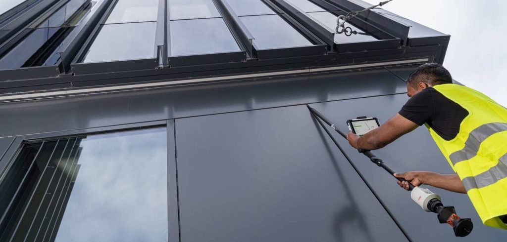
Tilt compensation is a feature that enables point measurements with a tilted pole, eliminating the need to level the pole and hold it steady during point measurement. Essentially, the AP20, replaces the individual levelling uncertainty of the pole operator with the certainty of a reliable IMU sensor.
Even when you must drastically tilt a pole to reach a point, you can be confident that the tip of the pole is always the point being measured. Tilt compensation makes points accessible that were previously too difficult to measure or even impossible to reach. At the same time, productivity increases because you can collect data or stakeout a location without slowing down to level the pole.
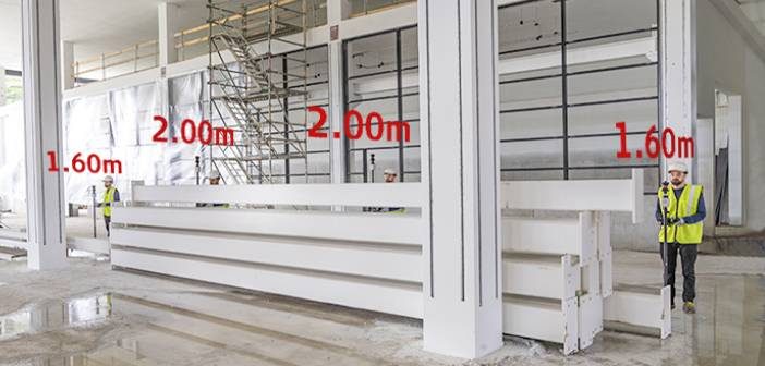
With PoleHeight, the AP20 automatically measures the current length of the pole and applies the detected changes in Leica Captivate v7.0 field software, removing the need to read, check and enter height changes manually in the field software. This also eliminates time-consuming post-processing to fix incorrectly entered or forgotten target heights, saving time in the office as well as in the field.
Conditions onsite are rarely static or predictable, you might often need to change the length of the pole to ensure line of sight to the Total Station over obstacles. With the AP20’s PoleHeight functionality, you can easily adjust the height to accommodate the situation, with the assurance that the correct pole height is always recorded.

The TargetID function enables the Total Station to uniquely identify your target during its search, preventing a lock onto other targets. This feature is particularly useful when several surveyors are working on a site together. Now with the AP20, Leica Robotic Total Stations and MultiStations can detect if the target is your target.
Productivity is significantly increased while performing survey tasks, saving time onsite, whilst also having the peace of mind knowing that every measurement is correct and human error is minimised.
The AP20 AutoPole proves to be a valuable complement to the Leica Geosystems Captivate system. Coupled with a robust design, the AP20 delivers a more efficient and flexible pole operation.
Contact our Survey team to learn more about the Leica AP20 AutoPole – info@globalsurvey.co.nz or 0800 453 422
SHARE THIS ARTICLE