
Precision Layout Solutions – Delivering Printed CAD Plans (Interview)
Categories:
Tags:
For our latest article, we interviewed Greg Avery from Precision Layout Solutions, a company embracing technology and specialising in providing digital construction site layout services.
Why did you set up Precision Layout Solutions?
As a Builder by trade, I spent years on the tools and experienced first hand the amount… Read More
Leica Captivate surveying equipment – How to handle the 3G shutdown
Categories:
Tags:

In New Zealand, all the major telco providers have indicated that they will be shutting down the 3G cellular network to free up low-band spectrum to extend 5G service in rural areas. One NZ (formally Vodafone), Spark and 2 Degrees will be ending their service soon starting from end of… Read More
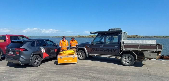
Patersons Dunedin: Transforming Coastal Monitoring with the Apache4 Hydrographic Survey Boat
Categories:
Tags:
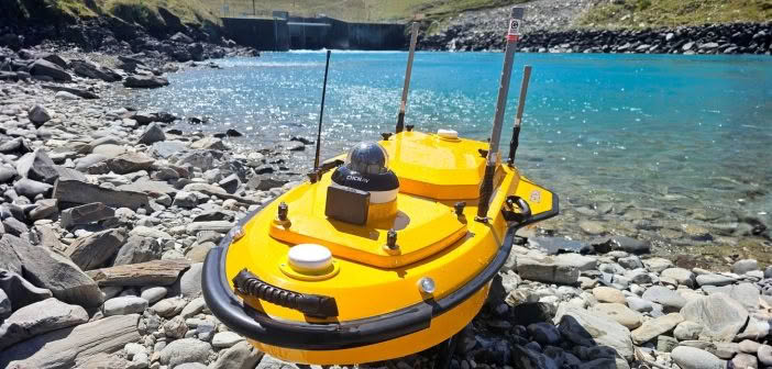
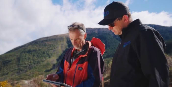
In our latest article, we caught up with the team at Patersons Dunedin office who have been putting the CHCNAV Apache4 hydrographic surveying boat to the test on a long-term coastal monitoring project along the Otago Peninsula.
The Challenges of Monitoring Coastal Change
The project focuses on tracking sand movement… Read More
CB Civil: Revolutionising Rail Safety
Categories:
Tags:
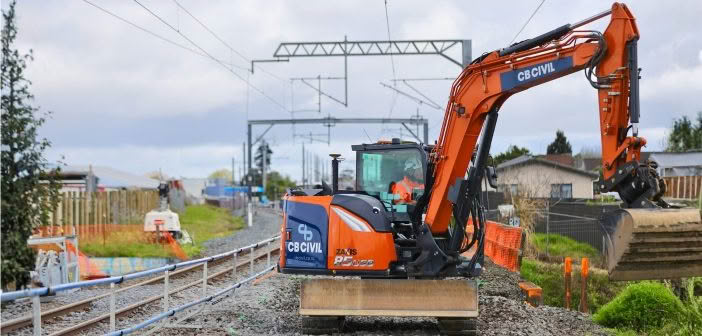
CB Civil trials digital geo-fencing technology to enhance safety and productivity on KiwiRail’s national upgrade programme.
KiwiRail’s Rail Network Rebuild (RNR) programme is focused on clearing maintenance backlogs, lifting infrastructure standards across the Auckland Metro area, and preparing the network for the operational demands of the City Rail Link (CRL).… Read More
Embracing Smart Technology – Can You Dig It’s Journey
Categories:
Tags:
In the competitive world of earthmoving and excavation, efficiency, precision and adaptability are what sets Contractors apart and provides them with a competitive edge. For Hawke’s Bay-based contractor Can You Dig It, these aren’t just buzzwords; they are the guiding principles that have propelled them to stand out in their… Read More
Introducing the New Leica BLK360 SE Laser Scanner and PinPoint Software!
Categories:
Tags:
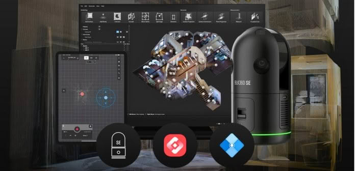
Precision, simplicity and affordability converge in Leica’s latest laser scanning release — the BLK360 SE!
Designed to provide fast, accurate and highly portable scanning capabilities, the Leica BLK360 SE is designed to enhance workflows in architecture, construction, engineering and beyond. When paired with PinPoint software, users unlock a streamlined, powerful… Read More
Mills Albert Providing High-Tech Tenstar Simulator Training
Categories:
Tags:

In a modern training centre in Paraparaumu, a trainee carefully maneuvers the controls of an excavator, precisely building a stockpile of large rocks. Nearby, another trainee navigates an articulated dump truck through the same worksite, maintaining a safe working distance.
While the heavy machines rumble, vibrate and sound off beneath… Read More
CHCNAV Apache 3 Pro: Addressing the Challenges at Whanganui Port with Hydrographic Surveying
Categories:
Whanganui Port Project Overview
Whanganui Port has long served as a crucial hub for both commercial and recreational maritime activities. However, recent challenges highlight the need for significant upgrades and improvements to ensure the port’s continued functionality and safety. This article outlines the challenges faced by Whanganui Port, and why… Read More
MS Civil: Delivering the dream result with Leica iCON technology
Categories:
Tags:
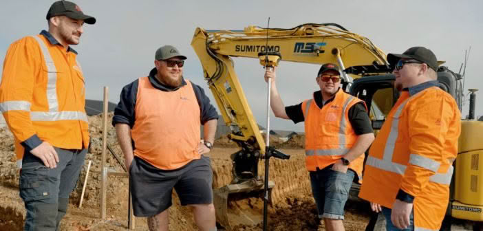
It’s a stunning day in the Waikato as we go onsite with the MS Civil team to discuss how their adoption of Leica iCON technology has impacted the business over the last few years.
We meet at the Lockerbie Estate – sub-division in Morrinsville, where earthworks are underway for 100… Read More
Unlocking GNSS efficiency in challenging environments with Leica multi-frequency solutions
Categories:

Selecting the right technology for a project is often dictated by accuracy requirements, with GNSS and Total Station being common choices. However, certain projects require the convenience and speed of GNSS, despite challenges like high multipath or dense overhead canopy.
Traversing through thick bush with limited line of sight can… Read More