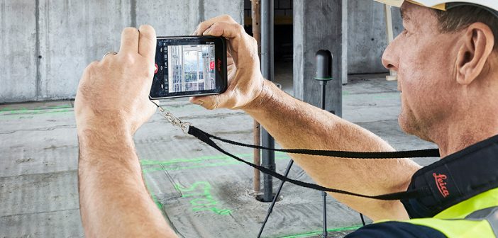
The Leica BLK3D captures images and 3D measurements from 2D photographs using stereo photogrammetry and edge computing, which can then be shared in multiple formats.
This webinar will show you how to use the BLK3D for ultimate onsite documentation and collaboration in conjunction with the Leica RTC360 and Leica BLK360. Onsite documentation can be enhanced when the BLK3D is also used with products such as Autodesk BIM360, advancing remote collaboration for applications such as architecture, engineering and construction.
This Leica BLK3D webinar will cover:
- How to add reality capture images to a plan
- How you can download a plan from BIM360 and then solve issues on site
- How to control your Leica BLK360 or RTC360 with the BLK3D
- How to tag using Reality Capture images and publish these images from the field
- Working with Cyclone REGISTER 360, publishing to Leica JetStream and Leica CloudWorx
- Upcoming updates of the BLK3D in 2020
Leica BLK3D webinar details:
Date: Weds 17 June 2020
Time: 4PM NZST [2pm AEST]
[Can’t make this time? Register to receive a recording of the webinar, and catch up in your own time.]
Presenters:
Gregg Franz – Reality Capture Segment Manager, Leica Geosystems ANZ
Tobias Heller – Senior Product Manager, Leica Geosystems
Daniel Harley – Construction Industry Consultant, C.R. Kennedy [Australia]
Experience level: This webinar is suitable for beginners through to more advanced users
Leica BLK3D: Ultimate Onsite Documentation & Collaboration Webinar:
The live webinar has already happened but you can watch the recording on demand here.
SHARE THIS ARTICLE