The Global Survey team recently ran two workshops for the final year students at University of Otago Survey School. From a practical perspective the plan was to demonstrate how the latest technologies are able to make graduates more productive and efficient for when they enter the work force at the end of their current year of study.
#1 Workshop: GNSS Sensor Integration
The theoretical side was about sensor integration and how the sensors work in unison to deliver results and use of the right sensor for the right task
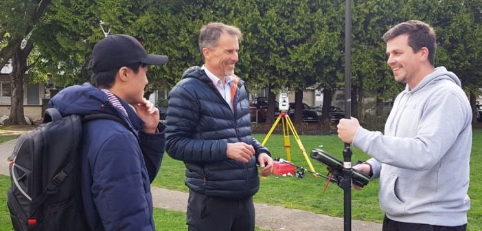
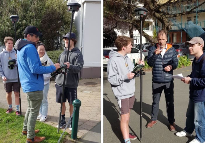
The first workshop focused of the use of the widely used survey software, Leica Captivate and the the relatively new Leica GS18i rover which utilises imaging and GNSS in a unique way to efficiently capture data in one visit. The AP20 Tilt prism pole and a Leica TS16 Robotic Total Station were also included to encourage discussion on combined GNSS and TS data and to compare data & speed of capture.
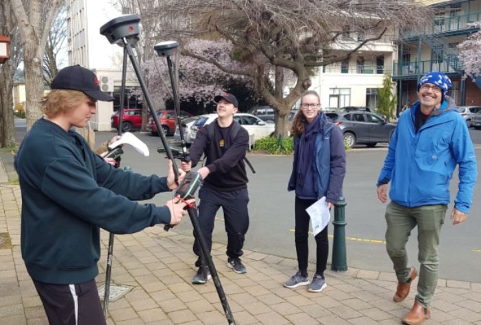
This workshop aimed to provide students with practical experience on how they would be using the technology in the field, once they become Surveyors and covered the following:
- How to configure Leica equipment.
- How to set up a job.
- How to capture and set out points from the job.
- How to use tilt rovers effectively and to let the students experiment and discover how imaging on a rover can work.
- How to export data and produce field notes from the instrumentation.
The field notes were then required to be reviewed and commented on before electronic submission.
|
“We started the day with a thought provoking presentation from Richard Harrison followed by plenty of practical experience outside putting the imaging rovers through their paces and testing their capabilities. Fair to say it was smiles all round when the students realised the speed and accuracy that can be achieved. It’s really important as graduates that they have this kind of exposure to the latest technology, before they go off into the workforce and start using it on a daily basis”. Bruce Robinson, Director – Global Survey. |
 |
#1 Workshop: Reality Capture Workflows
Technical specialist, Lennon Bedford, guided the students through a Scan to Mesh workflow for a historic building façade using data captured with the new Leica BLK360.
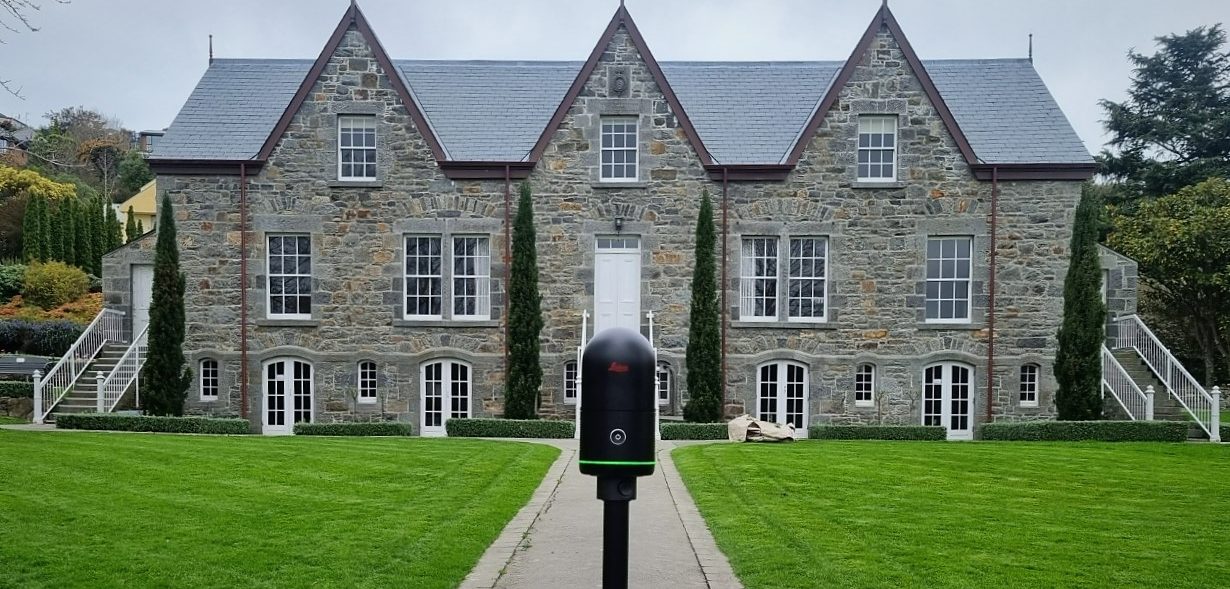
The new BLK360 capturing scan data used by the students in the workshop
Students were introduced to the fundamentals of Leica Cyclone REGISTER 360 software with a focus on the application of good survey practice in the registration of raw scan data.
The students went through the process step-by-step, from importing data to exporting deliverables:
- Importing & Reviewing Data
- Registration Basics
- Optimising Registration
- Applying Control / Geo-referencing
- Quality Assurance
- Exporting basic deliverables
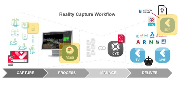
Reality Capture workflow overview
The resulting point cloud was then taken into Leica Cyclone 3DR software and the students were taught the process of converting a point cloud into a high quality textured mesh, which could then easily be shared with interested parties.
- Point Cloud Cleaning
- Meshing Basics
- Meshing Improvement (managing level of detail, filling holes)
- Texturing with real colour
- Export Mesh formats
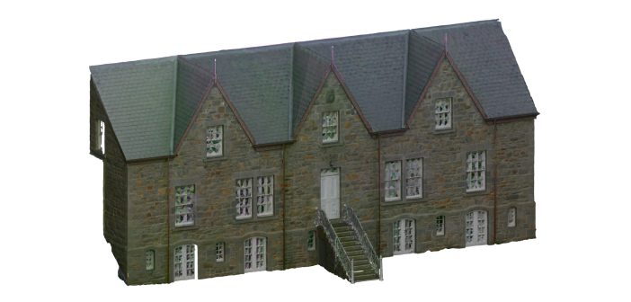
Final mesh of the scanned building
Students left the workshop with an understanding of benefits of Reality Capture technology and detailed documentation of the process, which could be applied on future project work.
 |
“It’s always great to be able to share our knowledges with the next generation of Surveyors and motivating to see the level of enthusiasm they have for laser scanning technology and workflows. I’m hoping that University of Otago Survey School graduates continue into their profession with an appetite for emerging technology as a key part of their digital strategy going forward”. Lennon Bedford, Technical Specialist – Global Survey. |
To discuss your training requirements with the team contact us on info@globalsurvey.co.nz or 0800 453 422
SHARE THIS ARTICLE