
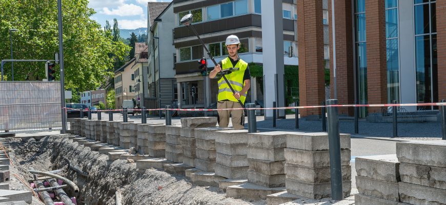
The modern practice of exporting Leica survey data uses stylesheets to create 12d field files. This export method allows all the survey metadata captured in the field to be utilised in 12d.
The whole process from capture through to design focuses on minimal manual metadata entry and provides a high level of quality assurance. This ensures the required standards are met, both in terms of the quality of the capture and the information obtained. The key is to be able to deliver efficient data over whole projects life cycle. This in turn reduces the risk of incorrect metadata flowing through into the Asset Managers workflow.
As the meta data is efficiently pre-populated and checked, the risk is further reduced of incorrect data being represented on the spatial plans produced for Council sign-off. The 12d Model has developed a workflow called “MetaConnex” that contains tools amongst others that automatically calculate attribute data, which then generates annotation label for PDF plans creation and export fully attributes data that can be consumed directly by a GIS system, therefore removing the manual rework within the TA.

Automatic labelling of asset attributes, as well as intelligent spatial labelling, such as connection chainage distances and depths, offsets from property boundaries and 3d BIM object creation, take a previously manual, time poor requirement and turn it into a highly automated process, with the correct data taken directly from the current 3D model.
Within MetaConnex 12d, user have tools that use Regular Expressions like “If” statements, to query a string name for example “MH” and then evaluate the “Depth” attribute, which in turn can create a new attribute, which can then be used within a Mapfile to change the dataset model. This muilt-step process, which could be combined into a Chain, after the user has reduced the dataset.
The same function, could be used to both report or highlight on the screen any attribute value, outside a set range ie “Satellites” less than 8 or ”Stake Difference” greater than 0.05m. MetaConnex attributes can be populated either from “in the field” user entered attributes via a code list or applied within the “Office Workflow”.
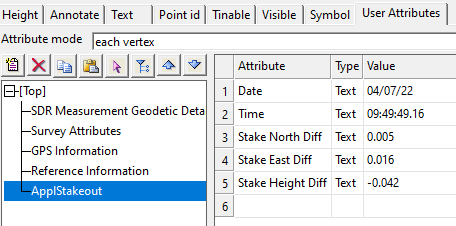
The configuration of the Attributes from the field data (be it coded or measurement attributes) is set in the Stylesheet. Therefore, it is possible to export data from an instrument/controller using different stylesheets to obtain a variety of import options in 12d including the metadata attributes.
Global Survey can help you with your code list or with the customisation of stylesheets to export the data you require with attributes that are prevalent to your workflow.
The potential is to improve your workflow, and the delivery of data.
Any queries about code lists or stylesheets please contact support@globalsurvey.co.nz
SHARE THIS ARTICLE