Many DJI drones in operation in NZ offer GNSS RTK capabilities and regularly connect to a local reference station or network RTK service such as SmartFix in real-time. However, there are circumstances in which a connection to a reference station network cannot be established or relied upon. These circumstances could include:
- Poor or non-existent cellular coverage
- Radio interference or range limitations with the RTK radio
- Use of base stations that don’t support the proprietary DJI communication protocol that is used to send corrections to the drone
The ability to post-process the DJI GNSS track in the office provides an alternative workflow to RTK, with the most accurate and reliable results possible.
This Post Processed Kinematic (PPK) workflow can be used to:
- Review and improve image positions collected from RTK UAV flights, where not all images were fixed in position.
- Process autonomous-only UAV flights to obtain centimetre level photo positions.
DJI Drone GNSS flight data and images in Leica Infinity software
Leica Infinity is user-friendly geospatial office software for measurement professionals.
Infinity is designed to manage, process, combine, analyse, quality check and share all field survey data from total stations, digital levels, GNSS systems and UAVs in one software.
With the release of Infinity v3.6.1, it is now possible to import DJI GNSS flight data and images, post-process the GNSS kinematic track and update the camera positions.
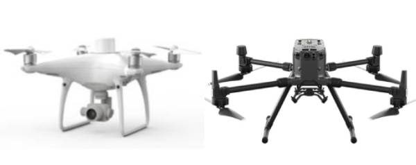
The DJI Phantom 4 RTK and Matrice 300 RTK are two popular DJI drones capable of collecting Raw GNSS data for post processing in Leica Infinity.
Following post-processing in Infinity, the images can are easily exported for further processing in specialist 3rd party photogrammetry software such as ContextCapture or Pix4D. Alternatively, the user can proceed with image processing in Infinity to produce deliverables such as Dense Point Clouds, Digital Surface Models and Orthophotos.
Completing the full process in Infinity allows the user to leverage control data and coordinate systems (including local Geoid files) already held within an Infinity project.
DJI Drone GNSS Post Processing Workflow in Leica Infinity
DJI RTK flight data contains the GNSS raw data and UAV images acquired by the drone. The workflow described here works for any DJI drone able to store raw GNSS data.
The files needed for processing in Infinity are:
- Timestamp.MRK
- PPKRaw.bin
Step 1: Import the images and GNSS Data
To streamline the import process, only one of the multiple raw files generated during acquisition is shown in Infinity at the import step.
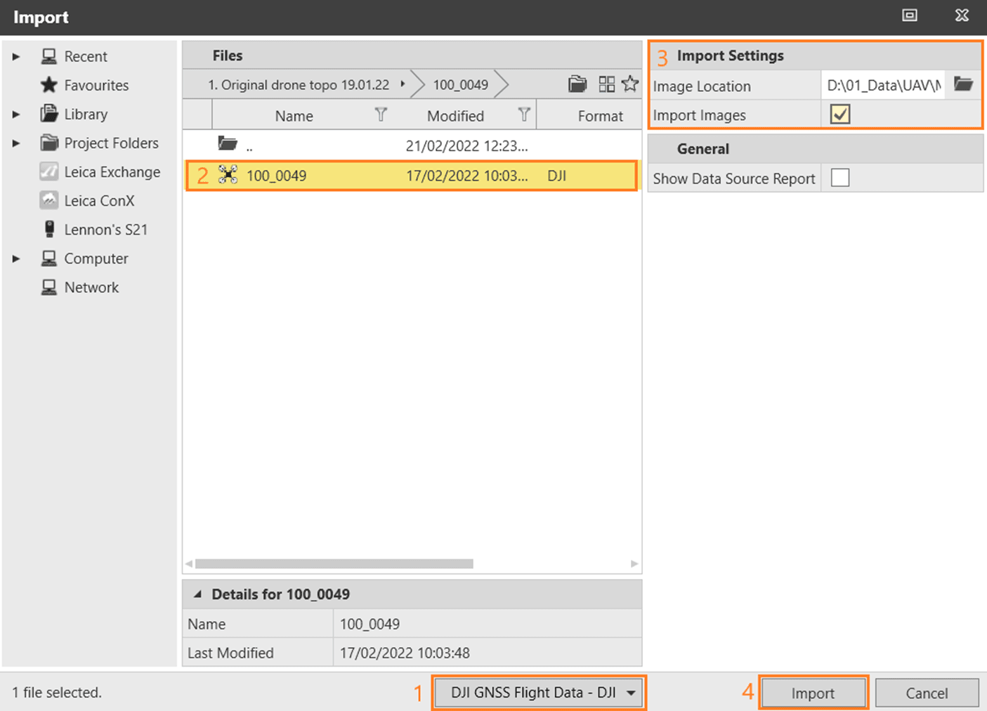
On import, all images and GNSS raw data in the selected image location are imported and organised in the application.
Step 2: Inspect the data
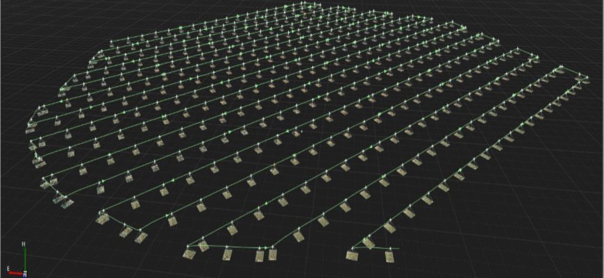
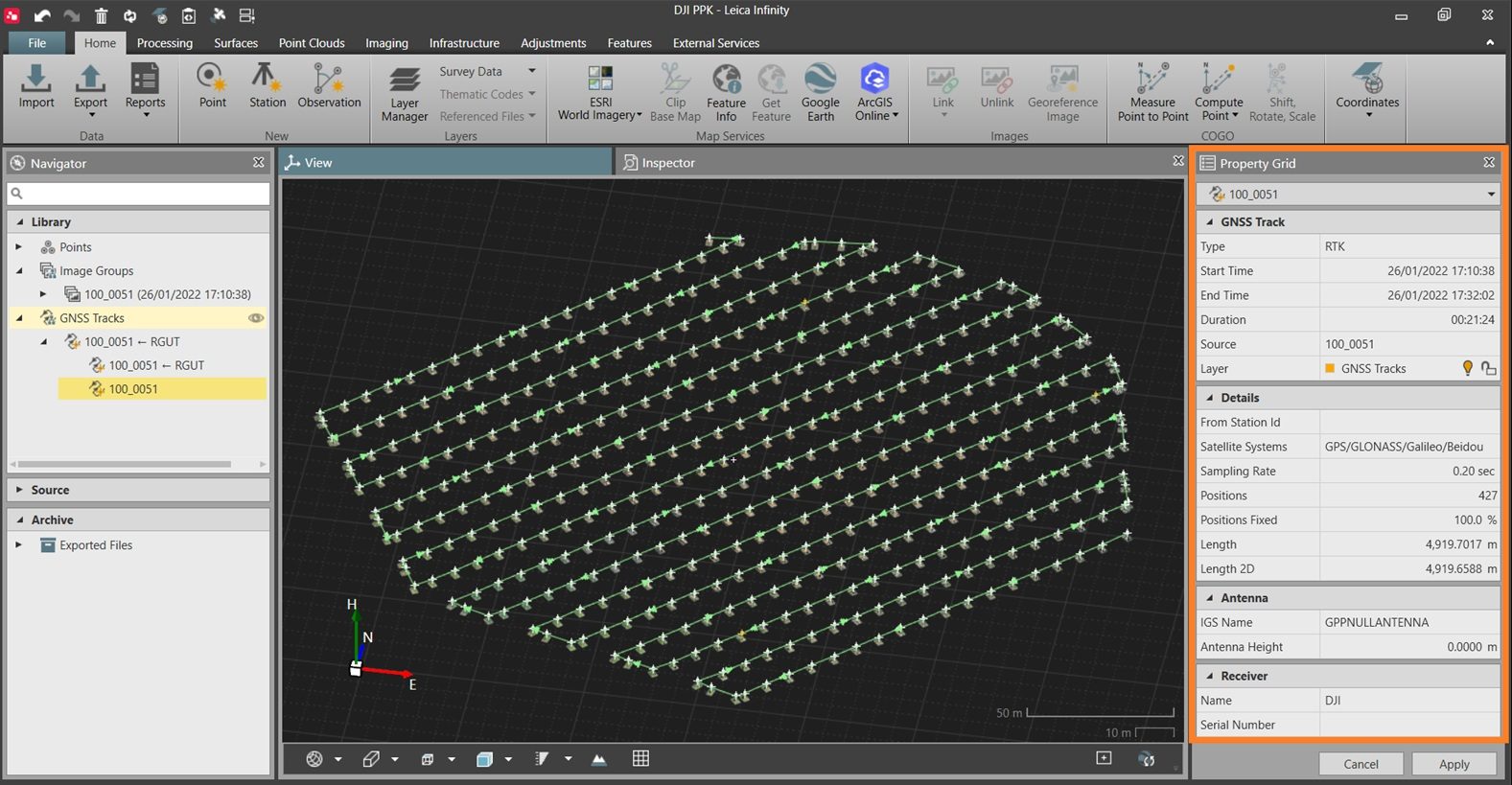
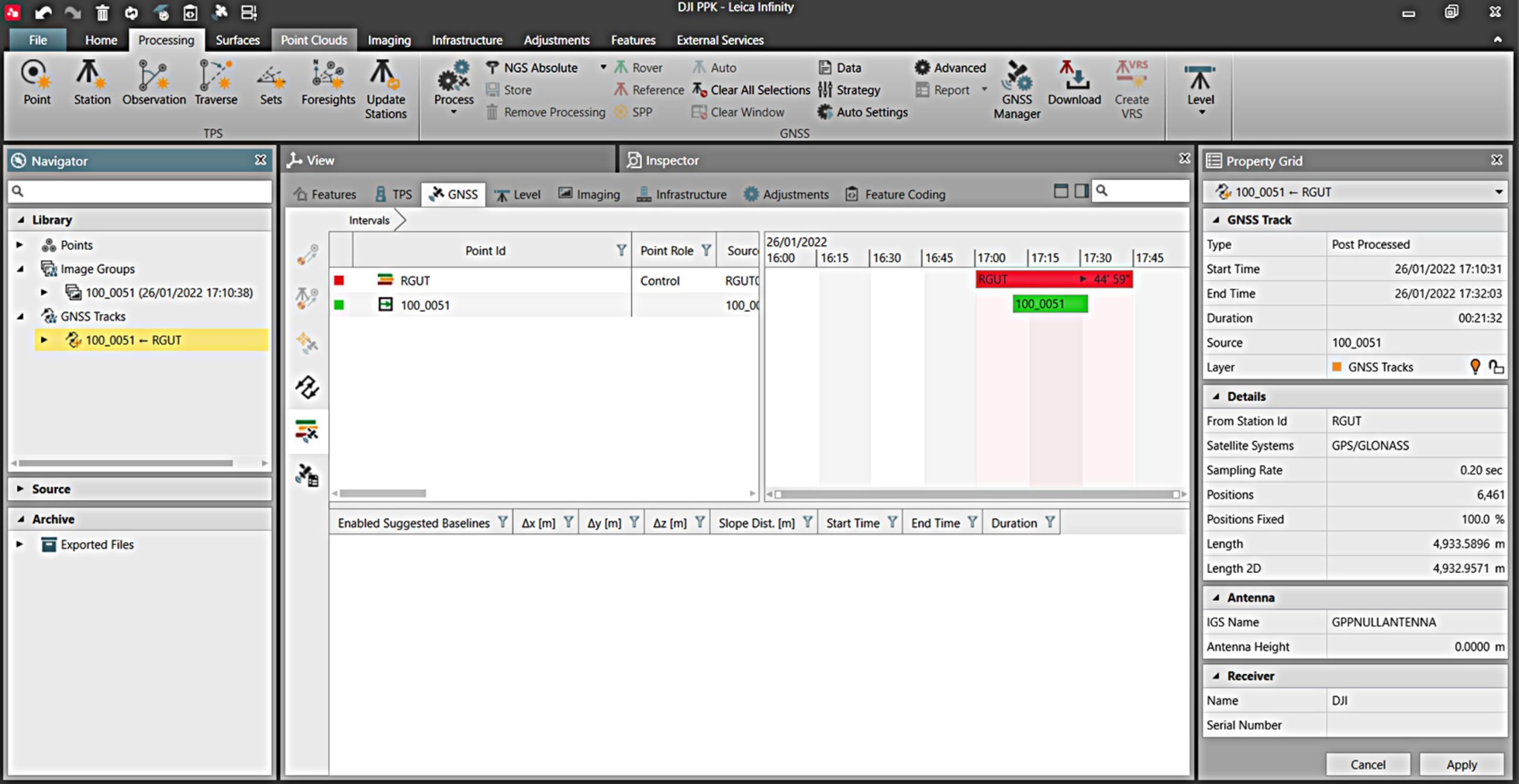
The Infinity View tab displays the 3D track of the drone, and many useful properties in the Property Grid such as:
- Track Type (RTK/Autonomous/PPK).
- Sampling Rate refers to the GNSS raw data sampling rate, which will be used during post processing.
- Number of Positions, which should match the number of images in the Image Group.
- Positions Fixed shows the percentage of positions (and images) with a fixed solution; a handy method of checking that all positions in a RTK track are fixed.
- Receiver Name is DJI.
In the Inspector tab, it is possible to view and filter based on the Event State (Fixed RTK, Float RTK, Navigated RTK) for each of the imported images as well as the Coordinate Quality.
Step 3: Post Process the UAV track
The GNSS Multi Frequency post processing option is required for this feature.
GNSS raw data from a nearby reference station is now required . This can be either downloaded through the GNSS Manager or imported from a file. The reference data could be from your own local base station or a Continually Operating Reference Station (CORS) from a network such as SmartFix in New Zealand.
Using the GNSS Manager in Infinity makes it easy to find the closest CORS and obtain reference data for the same time period as the DJI track.
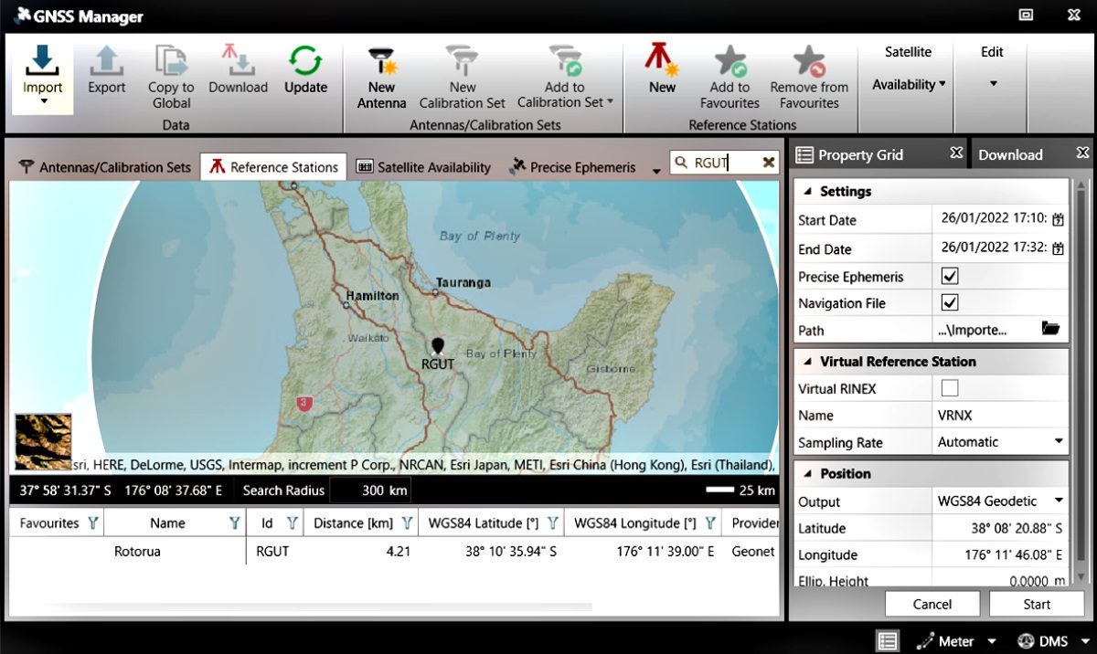
As the DJI data is a moving track (kinematic data) it’s important to ensure that the reference station data has a sampling rate of 1 second or faster to ensure accurate results.
For those familiar with the GNSS Processing module in Infinity, processing DJI UAV data is no different to processing data from any GNSS receiver:
- Set the reference station interval as Reference
- Set the UAV track as the Rover
- Select the Process button from the Processing ribbon bar
Step 4: Inspect the results
After processing is complete, the Results page in the GNSS tab of the Inspector opens automatically.
Information on processing results can be seen including the Solution Type, Frequencies, Coordinate Qualities, Fixed Positions etc. The data can then be filtered so only Fixed positions are stored
Step 5: Process the images and generate deliverables
To utilise the new high accuracy photo centres in 3rd party photogrammetry software, select the images and export them in jpg format with WG84 coordinates and either Ellipsoidal or Orthometric heights.
To continue processing in Infinity, the Infinity Point Clouds from Images license is required and offers a good solution for small to medium sized projects.
Users can orientate the images, check/adjust the results against ground control and generate Dense Point Clouds, Digital Surface Models and Orthophotos in terms of the project’s local coordinate system.
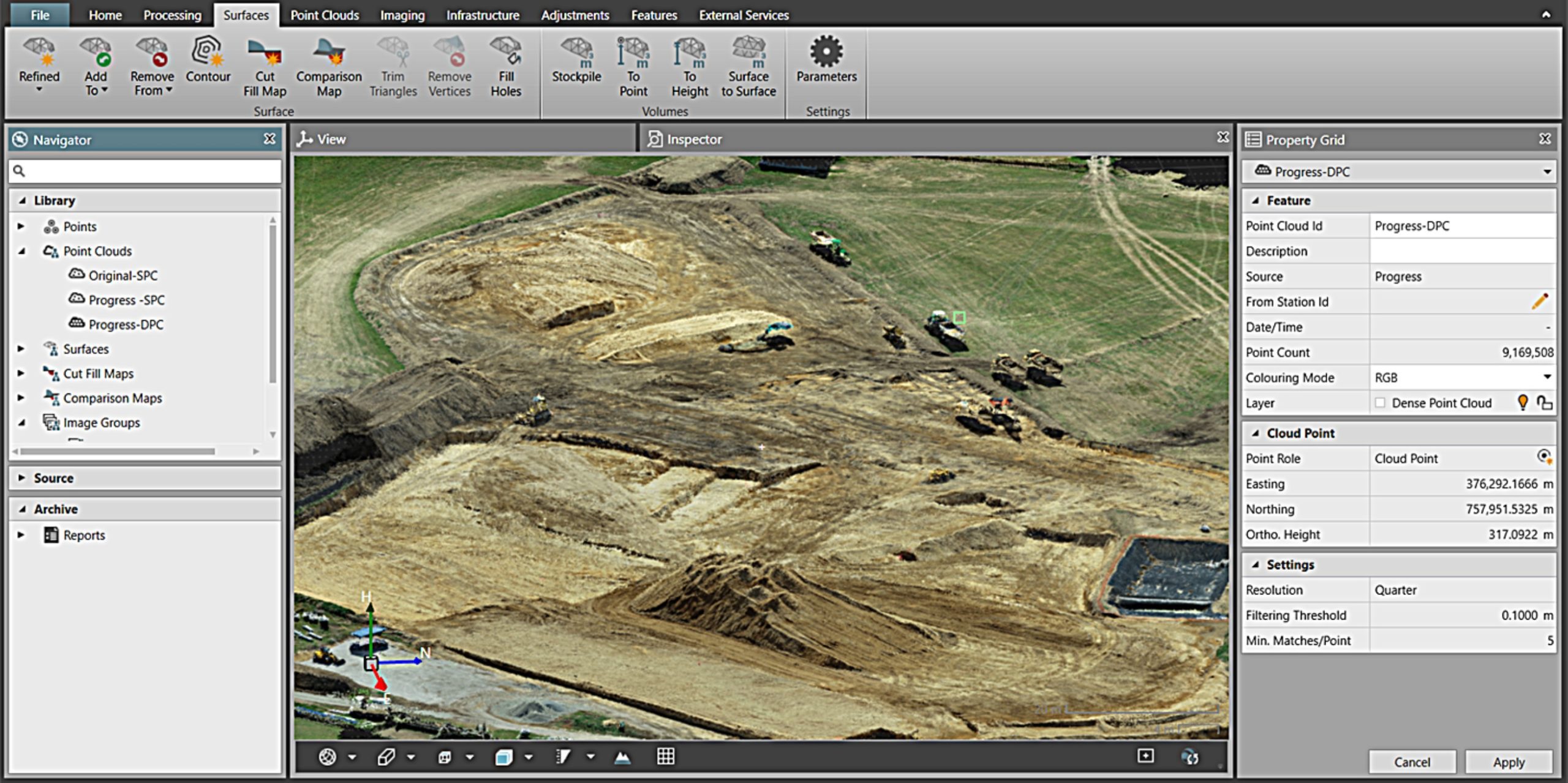
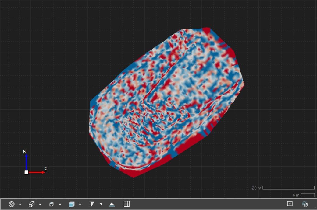
Image: Dense Point Cloud
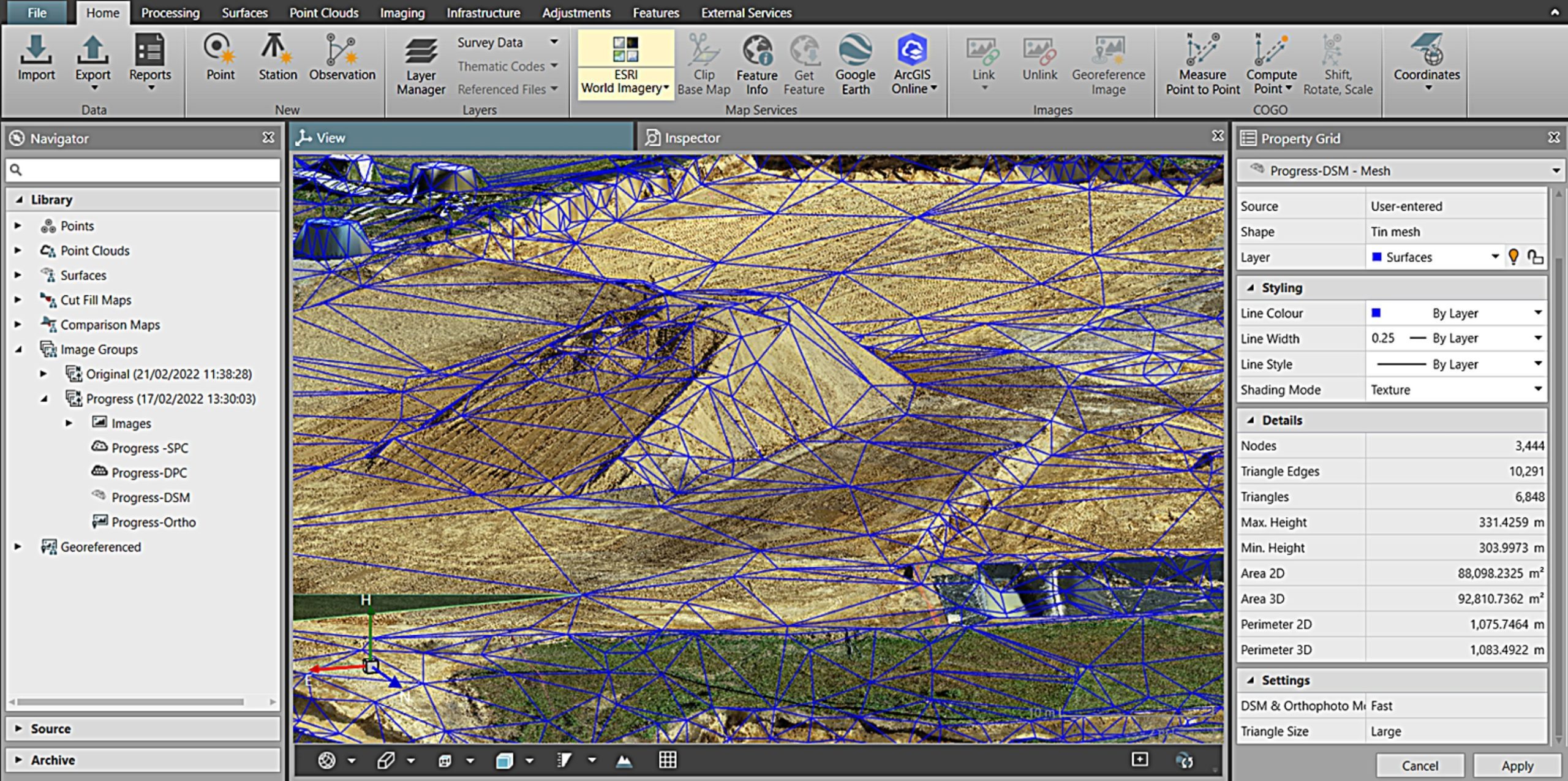
Image: Lightweight DSM
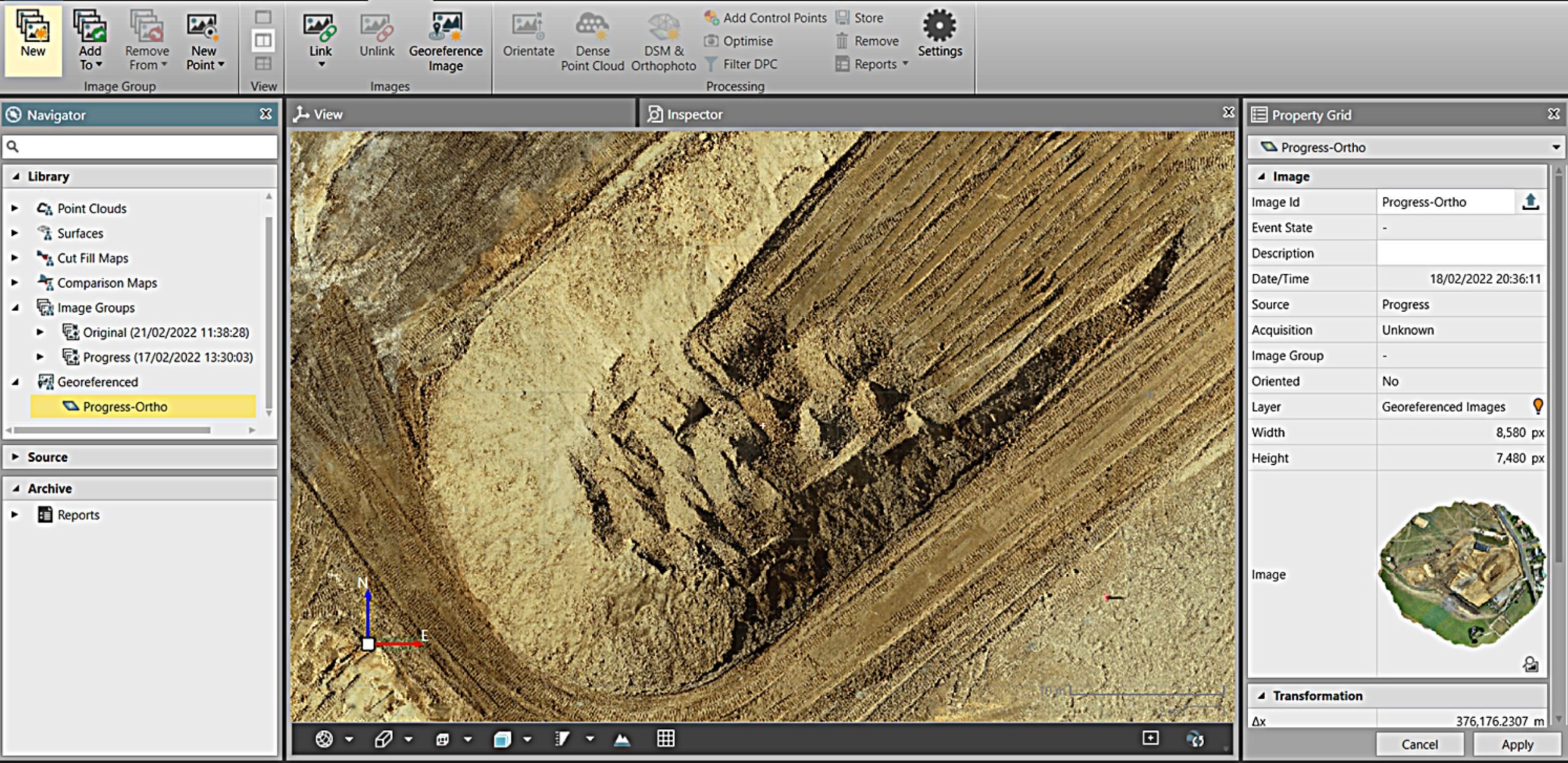
Image: Georeferenced Orthophoto
These deliverables can be exported for further processing, or to compete the entire workflow within Infinity.
The Scanning & Surfaces Infinity license allows calculations, analysis and reporting such as contouring, cut/fill maps, surface comparison maps and volume calculations such as stockpiles and surface to surface.
Summary
The ability to quickly and easily import raw DJI GNSS and image data into Leica Infinity provides a new level of transparency and quality assurance for RTK datasets as well as an efficient workflow for post processing data collected without a real-time connection.
The ability to seamlessly combine DJI data with existing survey data from total stations, digital levels, GNSS systems in a common coordinate system improves efficiency and leaves less room for error.
Our team of technical specialists can provide expert advice on a solution that is right for your requirements and also offer training, servicing and industry leading after-sales support.
Interested in knowing more about Leica Infinity & DJI Drone GNSS Post Processing?
Contact us by email to start the conversation or call 0800 453 422
SHARE THIS ARTICLE