It turned out to be a blessing in disguise when Envivo’s old laser scanner was damaged and needed replacing. What at first seemed like a disaster, quickly turned into a fortunate series of events.
Fortunately for them, there have been vast improvements in laser scanning technology over the last couple of years especially in the Leica Geosystems suite of scanning solutions. Nonetheless the purchase of a high-end laser scanner is not to be taken lightly, it is a significant investment for any company and requires careful consideration.
In order to be thorough, the Envivo management team applied their analytical skills to an evaluation of all scanners on the market including critical features, workflows, support and ROI.
Making The Decision
Although the Envivo team have been long-time Leica technology users on the survey side of the business, they were yet to embrace Leica solutions in their laser scanning division.
When Tim Jervis, our reality capture expert, walked them through the new Leica RTC360 they were impressed with the speed of capture, that was to be expected, it is the fastest laser scanner in the world capturing 2 million points per second. But there were many other factors that influenced their decision to invest in a Leica RTC360 laser scanner.
“We pushed our old scanner to the limit in terms of speed of capture and the RTC360 was just so much faster. We undertook extensive testing prior to finalising our decision, we kept looking for the downside however we found the Leica system to be extremely impressive, included the processing software. It came down to several factors, the quality of the Leica equipment, the speed of the RTC360 and the service from Global Survey. In the end, the decision became very easy for us.” – Mark Finlayson, Director, Envivo Ltd
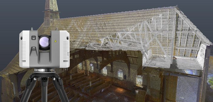
Putting The RTC360 Laser Scanner To Work
As a multidisciplinary firm with in-house planners, the Envivo team are involved in some of New Zealand’s largest infrastructure projects including airports, ports, roading, rail infrastructure, power distribution and petroleum pipelines. Their scanning client base is hugely diverse, often with planners, civil engineers, structural engineers and surveyors collaborating on a wide range of projects.
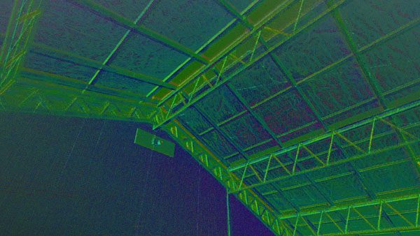
With several projects already underway, the RTC360 was put to work straight away on a number of Scan to BIM jobs for industrial plants, historic buildings, commercial buildings, apartment blocks and residential housing.
Mark told us “Our new RTC360 has been running hot from day 1!”
The Learning Curve
With change there is always a learning curve and that can sometimes seem daunting. Envivo had perfected the survey constrained cloud-to-cloud workflow with their old scanner and the team were used to that way of working. With the new RTC360, the capture and processing workflows had to be reworked to allow for the faster speed of capture, essentially the team had to adjust to the capability of the technology.
“The system is just so fast that we have had to change the fieldwork process, we just don’t get the time during scans that we used to. The office post processing has also been an adjustment, the superb HDR datasets are much larger and this requires management however the Cyclone Register 360 software takes all of the hard work out of post processing, it is very fast and again well thought out.”
Performance In The Field
The Envivo team are very excited to be working with the worlds fastest scanner and the feedback has been unanimously positive.
On the list of favourite features:
- Blistering speed
- iPad software for pre-processing in the field, significantly speeding up both capture and post processing.
- Saying goodbye to drawing scan layout diagrams.
- Being able to check and finalise the alignment of scans on the fly.
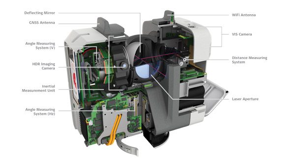
- VIS technology quietly does most of the work in the background, the iPad is used for final checks and refinement of the cloud to cloud links.”
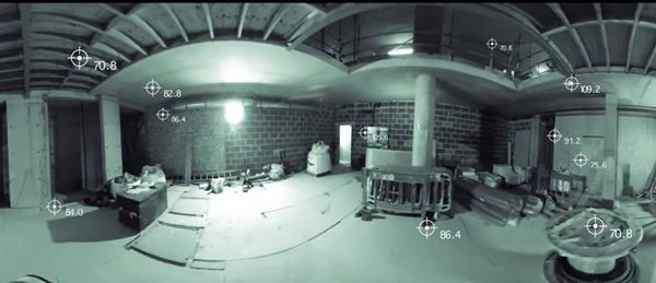
- HDR feature in dark environments produces fantastic imagery.
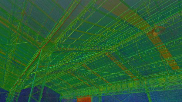
- The remarkable quality of the point cloud data, the clouds are very clean and very accurate.
“Initially, there was a concern that with the sheer speed of capture, the downside could be reduced quality of the data, but the combination of a very high quality instrument and post processing software working together tightly produces wonderful data that has really impressed our team.”
The Bottom Line
Envivo have put their RTC360 to work producing high quality deliverables for their clients, considerably faster than they were able to before. As a forward thinking team, they’ve enjoyed working with the RTC360 and have been able to adapt internal processes so they can match the speed of the technology they’re using.
“The bottom line is that we can now do a better job and in significantly less time, this has a direct commercial advantage for our scanning division and our clients.” – Mark Finlayson, Director, Envivo Ltd
Envivo Ltd are an integrated consultancy with offices in Auckland and Christchurch, offering services for land, property and infrastructure development. They seamlessly delivers a wider range of expertise across the engineering, surveying and planning fields.
Read more on Envivo scanning projects
Read more on Leica RTC360 – VIS technology and Live Position function
SHARE THIS ARTICLE