Hydro energy infrastructure plays a crucial role in the sustainable development of renewable energy sources. The structures that support Hydro Energy are subject to continuous environmental forces, especially in the New Zealand tectonic environment , that can cause deformation, displacement, and even failure.
To ensure the long-term integrity and reliability of these assets, it is essential to continuously monitor them for any signs of structural change. In recent years, Global Navigation Satellite System (GNSS) technology has emerged as a powerful tool for monitoring hydro energy infrastructure. This article will explore how Leica Geosystems’ automated GNSS monitoring system can provide continuous, independent measurements to help understand the movement of assets in 3D and how your team can benefit from attaining data correlation from complementary monitoring technologies.
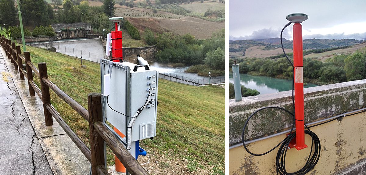
Leica’s automated GNSS monitoring system provides high-precision measurements for monitoring the movement of hydro energy infrastructure. The system uses a network of GNSS receivers that are placed at strategic locations around the asset. These receivers receive signals from multiple GNSS constellations. The data collected by the receivers is transmitted to a central server, where it is processed using advanced algorithms to calculate the position and movement of the asset in 3D. By combining the complementary technologies, including geotechnical sensors, engineers can obtain a more comprehensive understanding of the structural changes occurring in the hydro energy infrastructure.
The Leica Geosystems automated GNSS monitoring system provides continuous, independent measurements that can be used to detect even the slightest movements in the asset. This data is transmitted in near real time to engineers and maintenance teams, allowing them to quickly respond to any signs of structural change. With this information, engineers can make informed decisions regarding the maintenance and repair of the asset, improving safety standards and managing risk strategies.
| “Supported by Leica Geosystems powerful monitoring software, engineers can use GNSS monitoring data to develop predictive models that can help identify potential issues before they become significant problems” –Bruce Robinson – Director, Global Survey |  |
This proactive approach to maintenance can help prevent costly downtime and reduce the risk of catastrophic failure, ultimately improving the long-term reliability of the hydro energy infrastructure. The software allows engineers to view the data in real time and generate reports that can be used to track the long-term performance of the asset. By analysing the data over time, engineers can identify trends and patterns that can help inform decisions regarding the future maintenance and repair of the hydro energy infrastructure.
Ultimately, the use of GNSS technology and monitoring software can help improve the long-term reliability and sustainability of hydro energy infrastructure, supporting the transition towards a more sustainable future.
To discuss your monitoring project with the team contact us on info@globalsurvey.co.nz or 0800 453 422
SHARE THIS ARTICLE