

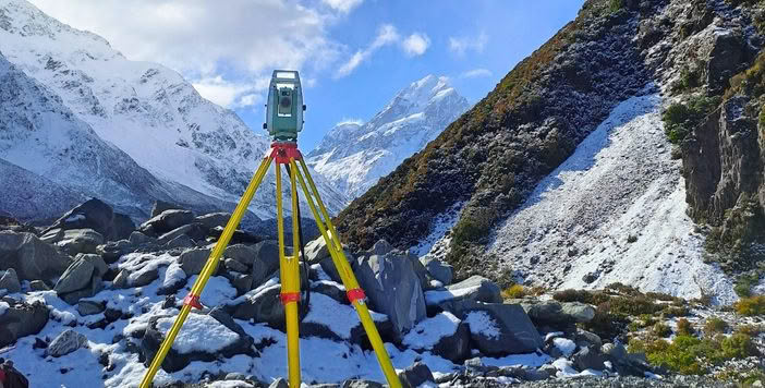
The Hooker Valley Track in Aoraki/Mt Cook National Park is one of the most popular in the country, providing access to the Hooker Glacier and spectacular mountain scenery. Following permanent closure of one of the historic swingbridges on the track, this new 189m hybrid suspension/swingbridge was completed in July 2026, re-opening the track to over a million visitors per year. The project required a high level of survey control, monitoring and as-built verification.
Leading that effort was Beca’s Christchurch-based survey team, headed by Survey Principal Chris Hyslop. Over an 18-month construction period, their team was responsible for ensuring every element of the bridge was positioned, measured and verified with precision. Equipped with a modern fleet of Leica total stations, GNSS receivers and laser scanning technology, they faced the challenge of delivering accurate survey data in one of New Zealand’s most demanding environments.
The project site, located in Aoraki/Mt Cook National Park, sits around four hours from Christchurch on the eastern side of the Southern Alps. With the bridge positioned beneath New Zealand’s highest mountain, the survey team worked through one summer and two alpine winters, often dealing with rapidly changing weather, strong winds and extreme temperatures.
Before construction could begin, a reliable survey control network needed to be established. Using static GNSS techniques and connecting to nearby CORS stations, the team created the foundation for all subsequent survey work. Because the bridge was designed within New Zealand’s NZTM2000 coordinate system, a local grid was developed to eliminate what could otherwise have been significant scale factor errors across the east-west span of the bridge.
Precision Set-Out in an Alpine Environment
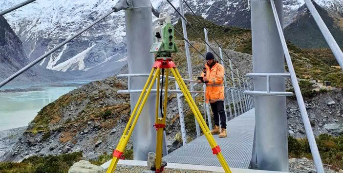
From there, the team set out the bridge centerline, abutments, towers and anchor blocks. Maintaining precise alignment between both ends of the bridge was essential. Even minor discrepancies could introduce twisting or distortion into the final structure.
The site’s notorious winds created another challenge. To keep the bridge stable, a network of support cables was connected to rock anchors drilled deep into the surrounding terrain. The exact position and angle of every anchor had to be set out with accuracy, ensuring the stabilising system would perform exactly as designed and helping the bridge withstand the harsh alpine conditions.
Balancing Construction with Conservation
Protecting the surrounding environment was equally important. Situated within a sensitive national park, every effort was made to minimise disturbance to the landscape. Detailed topographical surveys allowed the design team to build an accurate model of the terrain, helping optimise the bridge design, reduce earthworks and preserve as much of the natural alpine environment as possible.
Capturing As-Built Data with Laser Scanning
As construction progressed, laser scanning became a critical tool. The technology captured a comprehensive as-built record of both the bridge and its surroundings, creating highly detailed point cloud data. This information was used to verify the sag of the main span and the positioning of the wind cables, ensuring tension was evenly distributed throughout the structure.
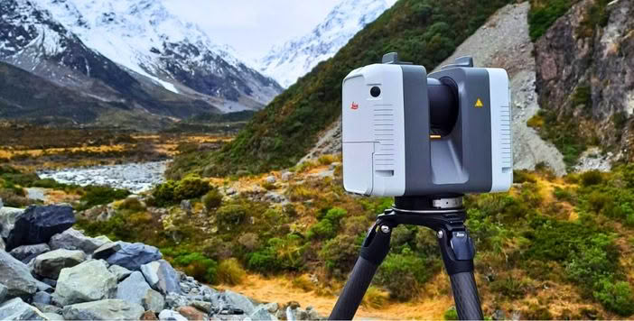
The data will continue to provide value long after construction is complete. The resulting point cloud serves as a baseline for future monitoring of the landscape, allowing surveyors to accurately track erosion and environmental change over time, a particularly important consideration given that the previous bridge was ultimately lost to riverbank erosion.

| “The biggest challenges were due to the Alpine environment, where the weather can change rapidly over time. Our survey team had to keep a constant eye on the weather to make sure equipment was adequately secured and protected, so that it performed well over the multiple site visits. The environment also delivered the biggest rewards for the field crews with amazing scenery in one of New Zealand’s most dramatic mountain settings. Working in the Hooker Valley is a privilege and knowing that this bridge will be used by over a million people every year means this is a legacy project for Beca’s survey team.” Chris Hyslop, Principal – Beca |  |
In the end, the project was about more than building a bridge. It was about combining technology, precision and expertise in a challenging alpine environment to create a structure that will safely serve visitors for generations to come. For Beca’s survey team, it is a lasting contribution to one of New Zealand’s most iconic landscapes.