


Kurloo is a brilliantly simple displacement and settlement monitoring technology that autonomously monitors risk and supports better informed decisions.
This cost-effective solution combines reliable all-in-one Kurloo units installed at monitoring points to collect data remotely and the Kurloo Nest cloud-based processing platform for data visualisation and analysis.

Combining Global Navigation Satellite System (GNSS), the Internet of Things (IoT) and cloud computing technology, Kurloo delivers mm precise and accurate insights to help you manage risk.
Automated surveillance
Once set up, Kurloo takes over. It conducts daily readings at scheduled intervals and handles updates remotely. Kurloo is thus perfect for challenging, hazardous, or restricted environments.
Point-specific accuracy
Kurloo enables greater frequency, consistency and precision of readings than traditional monitoring. With a clear view of the sky, Kurloo will deliver measurements within 3mm in X, Y & Z.
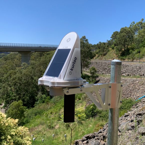
Clever, compact & lightweight
Fully integrated, everything Kurloo needs to do its job is right inside the device. GNSS chipset, ground level sensor, temperature, pressure and humidity sensors, accelerometer and solar panel – all in one neat little device.
Highly durable for all-weather use
With no exposed cables or wires, Kurloo devices boast a ruggedised IP66 rated design to withstand harsh environments. Proven in the field, Kurloo is a robust, economical and safe solution.
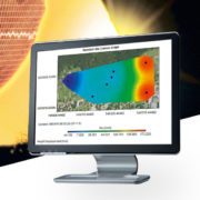
In the Kurloo Nest, the advanced cloud processing platform, your data is processed in near-real time after device readings. Access precise data easily through the Kurloo Nest, enabling secure management, adaptation, and exportation on demand.
Each Kurloo device, equipped with GNSS components and environmental sensors, detects environmental changes, allowing for customizable alerts. Integration with the Bureau of Meteorology enables better understanding of rainfall impact, with future machine learning and predictive analysis features