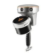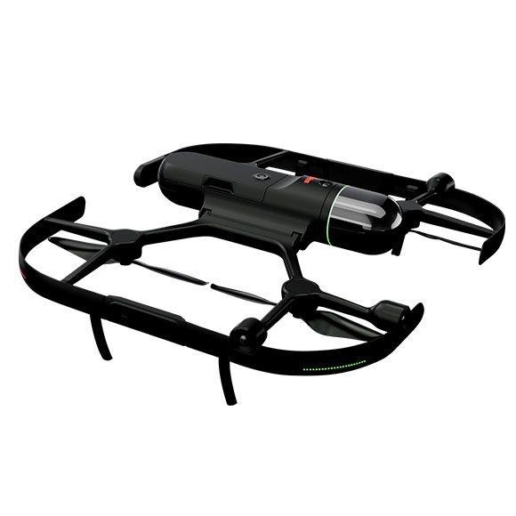

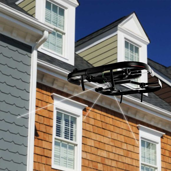
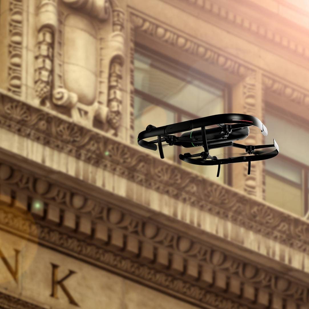
The Leica BLK2FLY is an autonomous flying laser scanner with advanced obstacle avoidance for easy reality capture from the sky. It captures building exteriors, structures, and environments to create 3D point clouds while flying. The BLK2FLY is designed to be easy-to-use: with a few simple taps on a tablet, users can set the BLK2FLY aloft to autonomously scan building exteriors and features, such as hard-to-access areas like rooftops and facades. Deploying the device itself is as easy as unfolding it, switching it on with the press of a button and placing it on the ground, ready for takeoff.
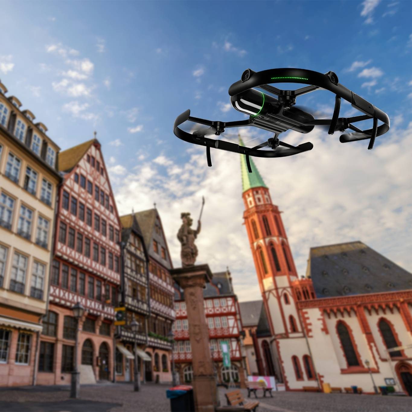
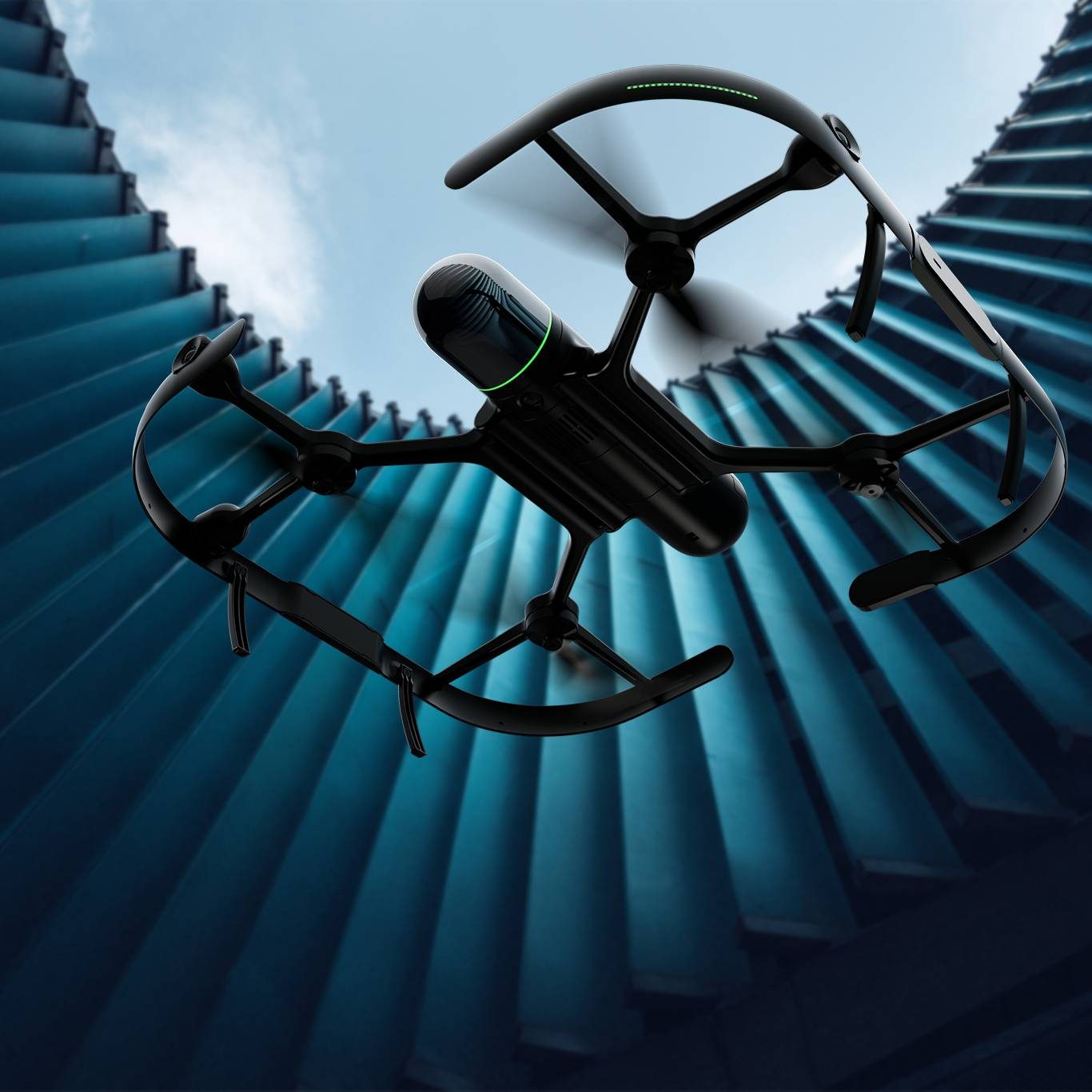
BLK2FLY autonomous flying laser scanner
- Allows you to scan hard-to-reach areas like building facades and rooftops
- Autonomously captures complete scans of building exteriors to create 3D digital twins
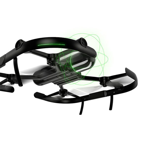
- GrandSLAM sensor fusion of LiDAR, radar, cameras, and GNSS for complete scan coverage, optimized flight paths, and shortest return to home
- Advanced obstacle avoidance for superior flight safety
- Hot swap battery system
- Lightweight, portable, easy to use
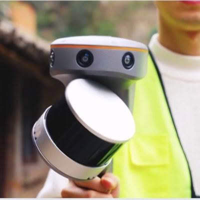
Users control the BLK2FLY through the BLK2FLY Live App on a tablet for simplified, app-based flying with no need for prior UAV experience. This allows for easy, intuitive control of the BLK2FLY, including live camera feed. You can select an area within the map on your tablet and the BLK2FLY will create its own flight path to scan it quickly and safely. You can also tap-to-scan: simply send the BLK2FLY to scan a new area by tapping anywhere on the 3D view in the app.
The BLK2FLY Live App also allows you to pilot the BLK2FLY manually with virtual joysticks on your tablet. This critical safety feature always keeps you in control. And for connectivity, the BLK2FLY includes WLAN and LTE communication channels to the tablet for nearly unlimited communication range during flight.
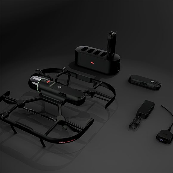
The BLK2FLY makes it easy to get your data into your preferred software and to share your scans with others. It also works seamlessly with other Leica Geosystems sensors and software. You can directly upload your data to HxDR with automatic conversion to OBJ and cloud-based visualization, and also allow others to access and work with your data, including data download, via HxDR. Or transfer your data to Leica Cyclone REGISTER 360 with USB-C or WLAN for scan-to-BIM workflows.
RELIABLE TRANSMISSION
Equipped with OcuSync 2.0, the drones now support automatic dual frequency band switching between 2.4GHz and 5.8GHz for up to 8 km maximum transmission range, delivering reliable, high-resolution, low-latency digital video transmission back to the pilot.
DATA SECURITY
All data transmitted through OcuSync 2.0 is encrypted using the leading AES-256 standard, ensuring critical mission information is protected and can only be accessed by authorized parties.
FLIGHT SAFETY
Designed with U.S. Federal Aviation Administration Night Waiver standards in mind, anti-collision beacons have been added on the top and bottom of the drone to improve flight safety during low-light conditions and at night. The drone is also equipped with DJI’s AirSense system using an ADS-B receiver to provide drone pilots with awareness of approaching air traffic that may pose a collision risk.
FLIGHT PERFORMANCE
A new TimeSync system continuously aligns the flight controller, cameras, GPS module and RTK module, as well as any third-party payloads or onboard accessories, fixing the position data to the centre of the image frame to achieve improved data accuracy.
ANTI-COLLISION BEACON
Equipped with new top and bottom anti-collision beacons, the V2 drones are visible at night or in lowlight conditions, making operation in less than ideal conditions safer.
DATA ACCURACY
Equipped with OcuSync 2.0, the drones now support automatic dual frequency band switching between 2.4GHz and 5.8GHz for up to 8 km maximum transmission range, delivering reliable, high-resolution, low-latency digital video transmission back to the pilot.
OBSTACLE AVOIDANCE
A robust FlightAutonomy system with front, bottom and upper sensors detect and avoids obstacles while enabling precision hovering so that you can fly with confidence.
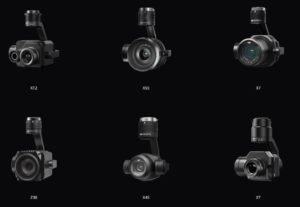
COMPATIBLE PAYLOADS
The V2 series is still capable of using third-party payloads
- ZENMUSE XT2
- ZENMUSE X5S
- ZENMUSE X7
- ZENMUSE Z30
- ZENMUSE X4S
- ZENMUSE XT
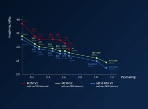
FLIGHT TIME BASED ON PAYLOAD CONFIGURATION
INTELLIGENT FLIGHT MODES
ActiveTrack: Keep moving subjects in a frame while you fly with ease to capture detailed data. Perfect for keeping track of missing persons while you relay their position to a rescue team.
Point of Interest: Easily circle your object of interest to focus on capturing the data needed for a detailed inspection.
Obstacle Avoidance: A robust FlightAutonomy system with front, bottom and upper sensors detect and avoid obstacles while enabling precision hovering so that you can fly with confidence.
RELIABILITY
Powered by TB55 batteries to properly support a dual gimbal configuration and increase flight times.
Dual batteries for improved reliability
Self-heating encasing for flight in sub-zero temperatures
APPLICATIONS
Power Line Inspection: Easily visualize extensive power line networks in remote areas.
Search and Rescue: Act quickly to locate missing people and better plan rescue missions.
Wind Turbine Inspection: Conduct safe and rapid wind turbine inspections with more ease than ever before.
Bridge Inspection: Perform inspections of bridges and complicated structures with a top-mounted camera.