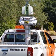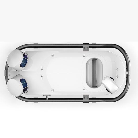

The Leica Pegasus TRK100 is a high-precision mobile mapping system designed for capturing highly accurate and detailed 3D data of roadways, bridges, and other transportation infrastructure.
The TRK100 is equipped with a variety of sensors, including a high-resolution camera, a laser scanner, and a GNSS (Global Navigation Satellite System) receiver, which allow it to capture data with sub-centimeter accuracy. It also features an inertial measurement unit (IMU) and wheel encoders to provide additional positioning and motion information.
The system is mounted on a vehicle, which is driven along the road at normal traffic speeds, allowing it to capture data quickly and efficiently. The collected data is then processed using specialized software to generate highly detailed 3D models of the road and surrounding environment.
The TRK100 is particularly well-suited for applications such as asset management, road condition assessment, and pavement analysis. It can be used by transportation agencies, engineering firms, and other organizations involved in the design, construction, and maintenance of transportation infrastructure.
Leica Pegasus TRK100 Features
Map what is where
Simplified data mapping to create your maps, your way. Built for large-scale infrastructure measurement and digital twin creation this powerful, lightweight and easy-to-use geospatial tool helps you to map what is where. Location intelligence was never easier to achieve.
Know what is where
Collect data and capture asset information quickly and autonomously, so you know what is where. Capture complete, large corridors with the SmartFusion camera system. Crisp, clear objects are more defined. MatchPoint technology and multibeam scanning deliver shadow-free point clouds. Knowing what assets are where was never easier.
See what is where
Fundamental location intelligence for georeferenced visual datasets within minutes to see what is where. Modular imaging system adds more cameras so no detail goes unnoticed. Capture vertical arches in high resolution for damage analysis or cast the eye up to see horizontal features like street signs or civic numbers in the thousands. Add a rear camera to focus on the road so no pot-hole is missed
MatchPoint
MatchPoint technology, a machine learning point cloud filter
MatchPoint technology in combination with multibeam scanning patterns delivers crisp and
shadow-free point clouds
Power that lasts the day
The Leica Pegasus TRK100 battery unit lasts up to 8h
Integrates an ingenious transportation mode for easy storage and shipping of Li-Ion batteries in line with IATA cargo regulations UN3481.
Designed to last
IP67 during operation, fully dust-tight and withstands temporary immersion under water
Withstands 4G shocks, ISO9022, MIL-STD-810H
Millimetric
Post processing [X,Y], [Z]: 19mm, 11mm
RTK [X,Y], [Z]: 21mm, 13mm