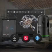

This is the Future of Mobile Mapping
Autonomous. Intelligent. Simplified.
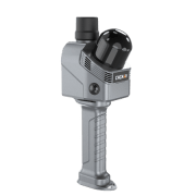
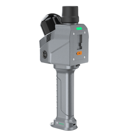
The Leica Pegasus TRK500/700 Evo is robust and reliable so you can map even the most demanding environments, delivering unchallenged performance for real-time results. The Pegasus TRK delivers greater levels of precision for critical transportation infrastructure maintenance in more clarity, faster than ever, to unlock new business opportunities.
The Future is Autonomous – Transforming mobile mapping with autonomous data collection for project completeness.
The Future is Intelligent – Delivering intelligence with advanced positioning, data-efficient sensors and adaptive imagery systems for rich, immersive detail to expand use cases.
The Future is Simplified – Simplifying set-up, operation and application to expand opportunities while reducing personnel resource requirements.
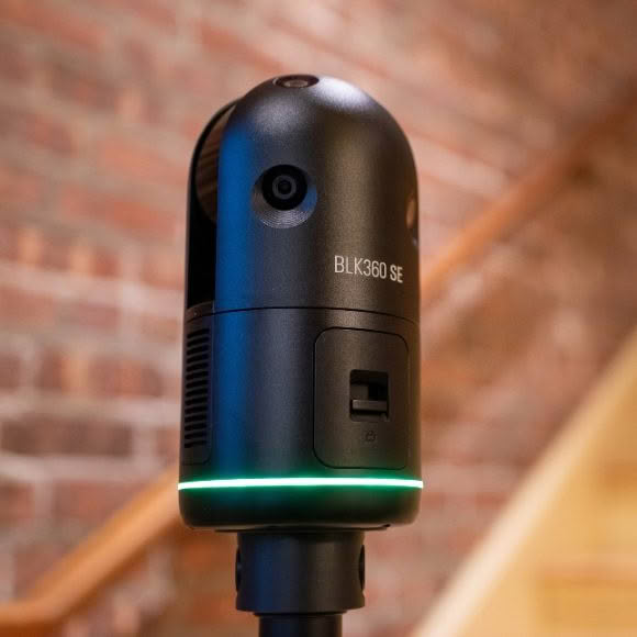
Pegasus TRK500 Evo – The data Efficient single scanner option, capturing 1,000,000 points per second.
Pegasus TRK700 Evo – With dual scanners for when greater point cloud density is required, capturing 2 million points per second.
Expand for more possibilities
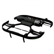
Pegasus TRK puts mobile mapping in the hands of more people than ever before. Simple to operate, the Pegasus TRK requires less training so you can cut costs but not performance. Weighing in at just 17kg with a unique rotating-tilting mounting platform and ergonomic design, Pegasus TRK can safely be set up and operated by just one person. Intuitive software guides you from project planning to project delivery.
Your world in millimeters
Measure roads and railways with surgical precision at the speed of traffic. Critical infrastructure was never easier to maintain. Proven accuracy meets next level precision with the Leica Pegasus TRK Evo. Structural imperfections become evident in dense and crisp point clouds. High-definition scanning and dedicated high-resolution pavement cameras take road inspection to the next level.
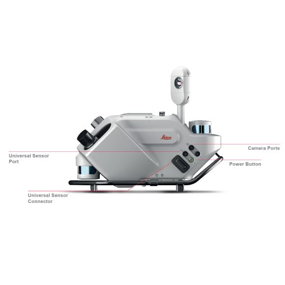
The mastermind behind it all
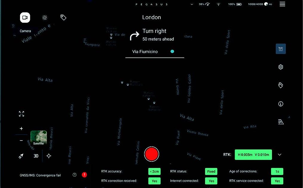
Plan and execute projects with confidence. Spontaneous visual and audio feedback along the route makes data collection failure a thing of the past. Pegasus FIELD predicts the time required for planned missions and storage and battery capacity needed to perform the job. Throughout the journey, image previews, accuracy estimations, and live system feedback instill absolute confidence in the data acquisition process.
Expand and Evolve
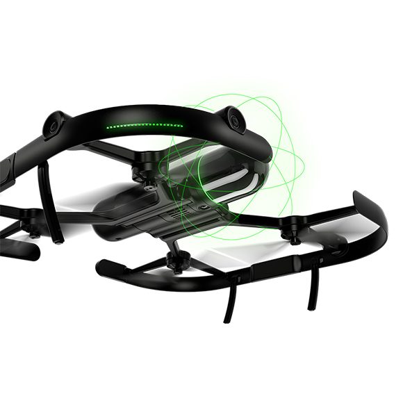
Your projects evolve – so does Pegasus TRK Evo. For more angles and greater detail, you can expand. Unique butterfly side cameras have a dual
position – vertical and horizontal – to capture vertical arches in high resolution for texturing and damage analysis or horizontal features like signs or civic numbers. Traffic signs are documented by the front camera and adding a rear camera expands applications by focusing on the road surface for detailed pavement analysis.
Bring images and data to life
Best-in-class colour truth – brought to life as it is in reality. Pegasus TRK features a SmartFusion ‘butterfly’ camera system with up to 120MP integral view. Boosted with add-on front, side and rear pavement cameras, TRK is expandable with a click. The additional cameras multiply the resolution, creating data-rich imagery. Enhanced calibration delivers true colour imagery according to the CIEDE2000 colour difference
formula.
A delta was never so small
The sophisticated integration of IMU and SLAM technology in Pegasus TRK’s sensor architecture enables geo referencing in challenging GNSS denied environments. Precision RTK positioning gives location accuracy down to the centimetre, in realtime. Trajectory is improved when optical DMI accessories are installed on the back of the vehicle to measure the travel distance in GNSS challenging conditions accurately, avoiding traditional slip error of wheel-based DMI.
Your business in motion
Fully integrated modular imaging system allows you to add more cameras for more angles, more detail and more possibilities. Automatic camera calibration simplifies and streamlines the system set up to expand and go. Collecting at up to eight frames per second, no details are missed.
Millimetric
Structural imperfections become evident in dense and crisp point clouds.
High-definition scanning and dedicated
high-resolution pavement cameras
Stay on track
Capturing at 1mm precision delivers confidence for critical clearance measurements
GNSS-agnostic SLAM technology for data collection in GNSS challenging canyons or tunnels
Built for the future
High-end engineering quality embraces sustainable manufacturing aspects
Designed to last
Hot-swappable battery units last up to 10,5 hours.
Robust and reliable design full fills IP66