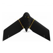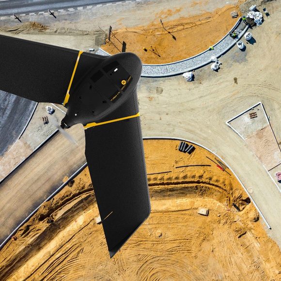


The DJI Mavic 3 Enterprise is a new generation of portable drone for land surveying. Optimised for drone mapping, this lightweight all-in-one solution features a 4/3 inch Hasselblad 20MP sensor with mechanical shutter.
The DJI M3E is a highly-efficient surveying solution: A large pixel size, 0.7s shooting shutter interval and a 45 minute flight time means that it can cover up to 16km2 in a single day. Combine with the RTK Module to achieve GCP-free, centimetre accurate mapping data. A versatile solution, the Mavic 3 Enterprise can achieve up to 56x hybrid zoom, making it ideal for inspection missions. Benefit from enhanced flight safety features, robust data security protocols and access to a full software suite, including DJI FlightHub 2.
IN THE BOX
Mavic 3E Aircraft × 1
Mavic 3 Intelligent Flight Battery × 1
microSD Card 64GB × 1
Gimbal Protector × 1
Mavic 3 Enterprise Series Propellers (Pair) × 3
RC Pro Enterprise × 1
Screwdriver × 1
USB-C Power Adapter (100W) × 1
100W Power Adaptor AC Cable × 1
USB-C Cable × 1
USB-C to USB-C Cable × 1
Protector Case × 1
DJI Care Enterprise Basic (Mavic 3E) NZ × 1
EXTRAS IN SURVEY COMBO
RTK Module × 1
Intelligent Flight Battery × 3
Mavic 3 Enterprise Series Battery Charging Hub (100W) × 1
SanDisk Extreme 128GB Micro SD Card with Adapter × 1
KEY FEATURES
Optimised for Surveying: Large pixel size
Wide Camera: 4/3 CMOS camera; 20MP; Mechanical shutter
Tele Camera: 12MP; 56x hybrid zoom
Lightweight, compact, and portable: 915g airframe
Ultra-long battery life: 45 minutes maximum flying time
Enhanced Flight Safety: Omnidirectional obstacle sensing and advanced Return to Home
Exclusive Controller: New DJI RC Pro Enterprise smart controller with high-bright screen.
Accessories: Including RTK Module for centimetre-level precision.
Full Software Suite: DJI Pilot 2; DJI FlightHub 2; DJI Terra.
Entry-level Survey Drone: The price point and size makes the M3E a great entry level surveying drone.
CAMERA
HIGH-CLASS SENSOR ENGINEERED FOR PRECISION DRONE SURVEYING
The camera on the Mavic 3 Enterprise enables it to be deployed as a specialised tool for aerial surveying and precision inspection missions.
Its integrated payload features wide and tele cameras.
The Mavic 3E’s large pixel size and Intelligent Low-Light Mode combine to offer significantly improved performance in dim conditions.
Wide Camera
4/3 CMOS Hasselblad sensor, 20MP
Large pixel size (3.3um) and shooting interval of 0.7s increase surveying efficiency
Mechanical shutter: Prevents motion blur and ensures no jelly effect under high-speed movement
Equivalent focal length: 24mm
Tele Camera
½ inch CMOS, 12MP
162mm Equivalent Focal Length
Up to 56x hybrid zoom
ENHANCED SURVEYING EFFICIENCY – MORE DATA IN A SINGLE FLIGHT
The Mavic 3 Enterprise is more portable, efficient and expandable compared to DJI’s other compact drone mapping solution: The Phantom 4 RTK.
With greater battery life, larger pixel size and shorter shooting interval, the Mavic 3 Enterprise is up to eight times more efficient than the P4 RTK (1cm GSD).
Tests show that, with a 5cm GSD, the orthophoto efficiency of the Mavic 3 Enterprise can reach 2.25 square kilometres: 1.9 times that of the Phantom 4 RTK.
NEXT GENERATION TRANSMISSION AND SAFETY FEATURES – GREATER PEACE OF MIND DURING FLIGHTS
The Mavic 3 Enterprise has enhanced safety features, including improved obstacle sensing and navigation systems and equipped with a robust transmission system.
DJI O3 Enterprise Transmission: Benefit from a maximum control range of 8km (CE). DJI O3 Enterprise Transmission enables operators to transmit signals with higher stability and obtain a high frame rate live feed at 1080p/30fps.
DJI AirSense: Receive ADS-B signals from traditional aircraft in the area to warn of other air traffic nearby, for greater airspace awareness.
DJI APAS System 5.0: The new improved DJI APAS system 5.0 for obstacle sensing with zero blind spots is supported by six omnidirectional fish-eye sensors.
Advanced RTH: The drone automatically determines the optimal route back to its home point and executes it quickly.
DATA SECURITY – PROTECT YOUR SENSITIVE DATA
The Mavic 3 Enterprise offers state-of-the-art security features to protect the integrity of photos, videos, flight logs and other data generated during sensitive flight.
Local Data Mode: When activated, Local Data Mode stops the DJI Pilot 2 flight control app from sending or receiving any data over the internet. This provides added security assurances for operators of flights involving critical infrastructure, governmental projects or other sensitive missions.
AES-256 Encryption: The radio link between the aircraft and remote controller features robust AES-256 encryption, ensuring critical information exchanged between the drone and its remote is protected.