
Maximum depth, high resolution and versatile design for superior productivity in underground surveys.
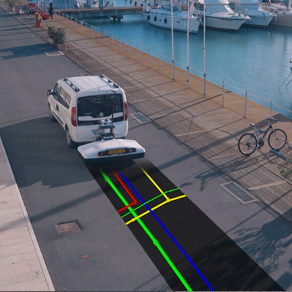
Stream DP is the revolutionary multichannel GPR array solution for real-time 3D mapping of underground utilities and features that overturns the state-of-the-art in underground surveys. Featuring the new radical Equalized scrambled Technology – EsT by IDS GeoRadar, Stream DP brings underground assets detection to the next level: the deepest one.
This ground penetrating radar offers unmatched performance maximizing asset detection to a deeper range compared to any other solution available on the market.
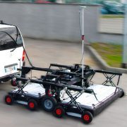
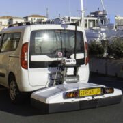
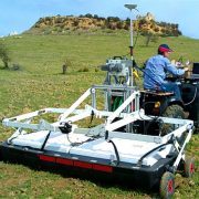
Ergonomically designed for easy handling and transportation, Stream DP can be efficiently deployed by a single user thanks to its light weight (max. 20kg per part) and its compact size that fits in a standard vehicle (116cmX82cm).
Benefits of Stream DP include:
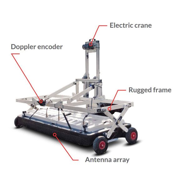
- Revolutionary EsT: Equalized scrambled Technology for unparalleled control of the GPR signal, extended depth range and ultra-high resolution;
- High productivity: a massive array (30 channels in double polarization, 19VV + 11HH) for an accurate 3D reconstruction of the underground utility network created in a single scan;
- Greater efficiency: One operator can assemble the system in less than 5 minutes and transport it with a standard vehicle;
- Non-Stop Performance: Non-stop surveying performance with low battery power consumption (15W-19W) and hot swap technology for the power supply;
- User-configurable: One solution for different scenarios: Stream DP is configurable both in rugged and asphalt version.
EsT | Equalized scrambled Technology
EsT Technology sets a new deep in utility detection, this technology is able to exploit the entire radiating performance of the antenna for a full control of the GPR signal, performing the best noise rejection and capturing both the lower and higher frequencies for an extended depth range and an ultra-high resolution.
This innovative technology, patented by IDS GeoRadar, offers unachievable GPR performance until now, locating buried objects successfullyis now free of compromise in choosing between depth range and resolution. Thanks to EsT technology, Stream DP is able to offer an unparalleled GPR performance maximizing assets detection in a deeper range compared to any other solution available on the market.
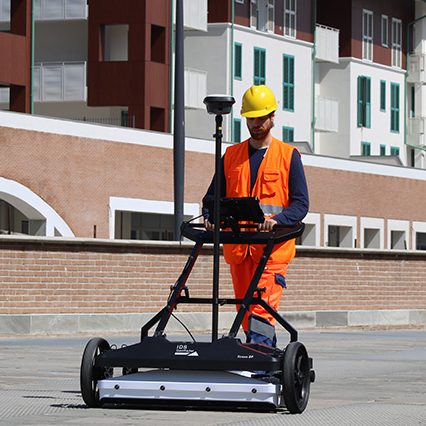
Asphalt & Rugged configuration
Stream DP is a modular system offering an optimized hardware configuration designed to perform in different environments: from asphalt (pivoting wheels) to rugged terrain (terrain wheels).
Fast assembly
With Stream DP, surveys are facilitated and successfully conducted by a single operator as the system can be effortlessly transported and assembled in less than 5 minutes directly on the field.
Highest accuracy
Pulse-per-second (PPS) integration into Stream DP’s antenna supports precise synchronisation with GPS, ensuring users achieve the most accurate positioning data which is crucial for data alignment.
Easy data management
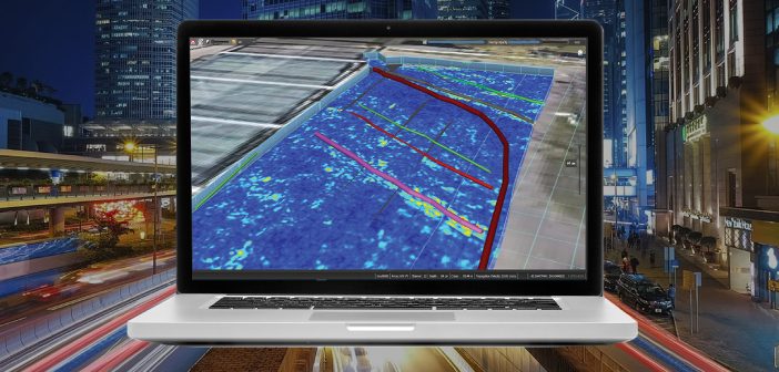
Stream DP employs the latest software technology solutions for data collection and post-processing: uMap – the on-field software for easy radar data collection, and IQMaps – the post-processing software for faster and smarter data analysis.
IQMaps is a new post-processing software application for advanced GPR data analysis, which provides a fast interfacing between the user and the GPR data. Machine time has been reduced and, contemporarily, real-time processing, advanced target management and 3D visualization have been introduced. In addition to underground assets detection and mapping, other functionalities are available for 3D mapping of sinkholes, inspection chambers and archaeological sites. IQMaps provides a step by step approach to guide the user in performing the best and the quickest data analysis with the help of a customisable processing and analysis tool, both for skilled and not skilled users for utility mapping, archaeological and environmental surveys and extensive mapping of large size projects.
FEATURES AND BENEFITS
Revolutionary interface
Allows an immersive reality during post-processing phase
Large areas acquisition
There is no limit in software use even for acquisition of large areas
User friendly
Ease of use and productivity have been dramatically increased (up to 30.000 sqm in a working day)
Georeferenced data
The new software has been developed with the precise aim to elaborate a georeferenced data after that it has been processed
Data easy to be managed
Intuitive interface with data ease to use and to be managed (scroll, pinch, spread)
Easy data extraction of various subsoil features
Anomaly detection (sinkholes, substations, buried objects)