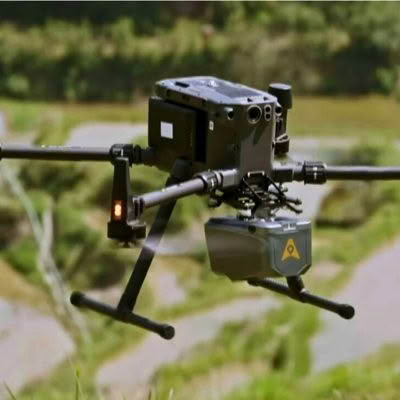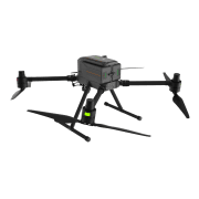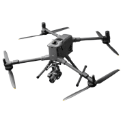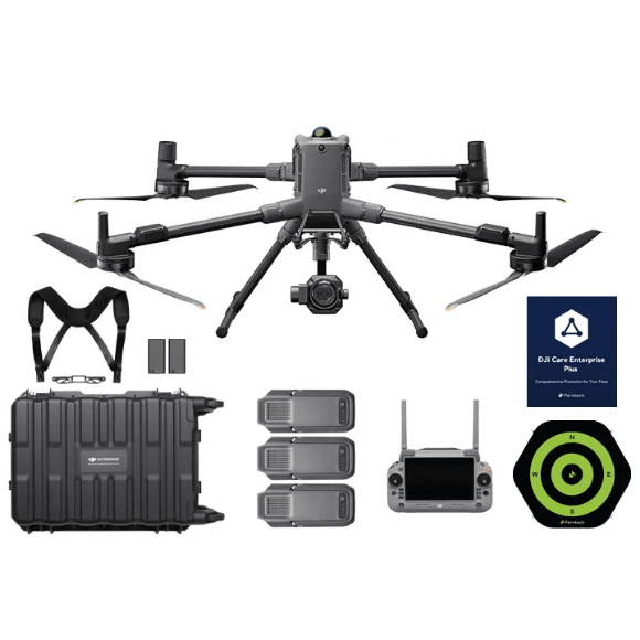
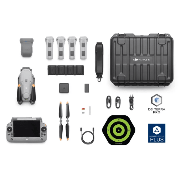
Introducing the DJI Matrice 4 Series, a new compact and intelligent multi‑sensor flagship drone lineup for enterprise use. The series includes the Matrice 4E, equipped with advanced capabilities such as smart detection, precise measurement, and a laser range finder. With enhanced sensing and AI‑powered systems, flight operations are now safer, more reliable, and more efficient.
Accessories across the Matrice 4 Series have also been significantly upgraded. The Matrice 4E is designed for geospatial applications including surveying and mapping, construction, and mining.
A new era of intelligent aerial operations begins now.
Rapid 0.5-Second Interval Shooting
The Matrice 4E wide-angle camera supports rapid 0.5-second interval shooting in both orthophoto and oblique photography modes, enabling high-speed aerial surveying from multiple angles. Additionally, the mapping flight speed can reach up to 21 metres per second, significantly enhancing work efficiency.
Multi-Directional Capture, Efficiency Multiplied
The Matrice 4 series supports a new 5-directional oblique capture. The gimbal can intelligently rotate and shoot at multiple angles based on the survey area, achieving the effect of multiple shots in a single flight compared to previous models, significantly enhancing the efficiency of small drone oblique photography.
Smart 3D Capture, Precision Modeling
DJI Matrice 4E supports Smart 3D Capture, which allows you to capture and create a rough model on the remote controller. Based on the rough model, it can quickly generate precise mapping routes close to a structure’s surface, completing detailed measurements and modeling of irregular buildings. It also supports displaying virtual space routes and waypoint photos for smart 3D capture, making it convenient to assess specific routes’ flight safety and coverage area.
Distortion Correction, Precision Enhancement: Distortion Correction 2.0 provides high-precision in-camera distortion correction with residual distortion less than 2 pixels. Each Matrice 4E’s wide-angle camera is calibrated before leaving the factory, when used with DJI Terra, it significantly improves reconstruction accuracy.
Auto-Generated Surveying Operation Report: Upon completion of an operation, DJI Pilot 2 can automatically generate a survey quality report. This report provides comprehensive access to key information such as photo points, RTK status, and photo parameters. If there are any anomalies, additional photos can be taken on-site to avoid repeated trips.
Fusion Positioning, Safe Return-to-Home
The Matrice 4 series comes with an integrated DJI RTK module which supports the extended L5 frequency band and features GNSS+Vision Fusion Positioning and Navigation System. It allows for the return-to-home point to be updated through visual positioning, allowing for rapid takeoff within 15 seconds. Even without GNSS signals, it can complete the return-to-home process, effectively overcoming signal obstructions and interference commonly found in urban environments.
Intelligent Guidance, Unobstructed Flight
When the DJI RC Plus 2 Enterprise remote controller is connected to the internet, it can load terrain elevation maps and preload detailed maps. This enables automatic path planning for obstacle avoidance, effectively managing scenarios such as flying at night or through mountainous areas, ensuring the safety of flight operations. The drone has a 5-directional vision assist view system along with downward vision, which aids in providing comprehensive visibility for enhanced protection.
| Category | Matrice 4T | Matrice 4E |
|---|---|---|
| Camera System | Triple 48 MP (Wide + Medium Tele + Tele) | 20 MP Wide + 48 MP Medium Tele + 48 MP Tele |
| Video | 4K 30fps / FHD 30fps | 4K 30fps / FHD 30fps |
| Zoom Capability | Up to 112× Hybrid | Up to 112× Hybrid |
| Thermal Camera | 640 × 512 @ 30 Hz, 28× zoom | Not included |
| Laser Rangefinder | Up to 1800 m, ±0.2 m + 0.0015D accuracy | Not included |
| Max Flight Time | 49 minutes | 49 minutes |
| Max Flight Distance | 35 km | 35 km |
| Max Wind Resistance | 12 m/s | 12 m/s |
| Max Speed | 21 m/s | 21 m/s |
| Sensing System | Omnidirectional vision + downward IR | Omnidirectional vision + downward IR |
| Transmission | O4 Enterprise, 25 km (FCC) | O4 Enterprise, 25 km (FCC) |
| Battery | 6741 mAh, 99.5 Wh | 6741 mAh, 99.5 Wh |
| Controller | RC Plus 2 (7.02″, 1400 nits) | RC Plus 2 (7.02″, 1400 nits) |
| Best For | Public safety, emergency response, inspections, search & rescue | Surveying, mapping, construction, mining |