


UAV companies and surveying and engineering firms, leveraging reality modelling in-house, can utilize ContextCapture Cloud Processing Service to upload photos and/or point clouds to generate 3D engineering-ready reality meshes, orthophotos, digital surface models, and point clouds dramatically faster than before. This high-performance, cloud-based service automates the production of 3D models of virtually any size or precision without the need for high-end hardware or specialized IT support. ContextCapture Cloud Processing Service enables faster processing and reconstruction of reality meshes thanks to the support of its unique parallel processing using multiple engines using the latest cloud technology.
You can leverage a simplified setup to quickly scale your projects and expand use to any project team to easily document as-is context affordably, with less investment of time and resources. Through the use of the ContextCapture Cloud Processing Console or ContextCapture Mobile application, you can quickly upload imagery to produce 3D models. This service is easy to use and simple to set up, making it practical for any organization to provide precise real-world context for all phases of an asset’s lifecycle
- ContextCapture Console – Enables instant uploading of photos and/or point clouds and setting of ground control points for generating 3D reality meshes. Download the ContextCapture Cloud Processing Console.
- ContextCapture Mobile – Easy-to-use reality modelling app used to quickly create and display 3D models from photos taken with a phone or tablet. Download the ContextCapture Mobile app from the Apple Store or Google Play.
Your reality modelling data will be stored in ProjectWise ContextShare, a cloud service that extends Bentley’s connected data environment. Reality meshes can be securely uploaded to ProjectWise ContextShare and then streamed to ProjectWise users for use in design, analytical, and construction modelling workflows. This high-performance cloud service makes the use of very large reality meshes practical providing context for engineering and geospatial workflows.
The reality modelling visa subscription is required and is your entry point to ContextCapture Cloud Processing service and all other reality modelling cloud service.
Consume imagery from many cameras and sensor types
Utilize a wide variety of cameras, from smartphones to highly-specialized airborne or terrestrial multi-directional acquisition systems. Take advantage of any available image format and metadata to create 3D models.
Generate 2D and 3D GIS models
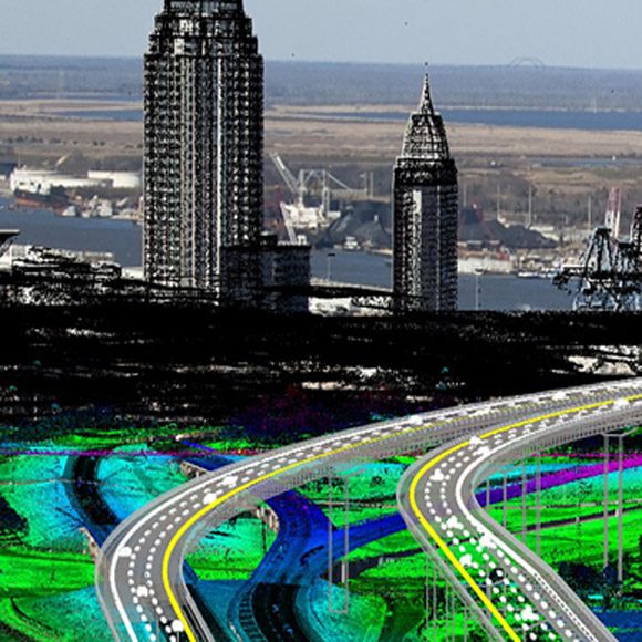
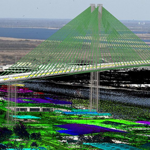
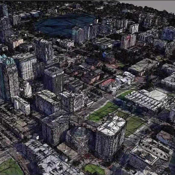
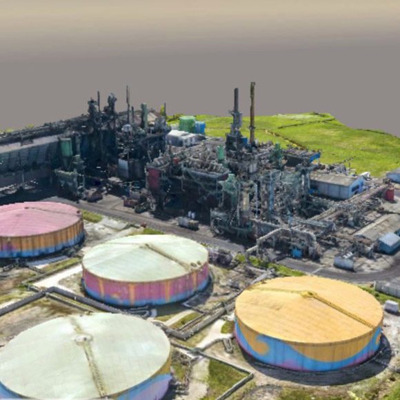
Produce accurate geo-referenced 3D models using a full range of geospatial data types including true orthophotos, point clouds, and raster digital elevation models. The application includes an SRS database interface to ensure interoperability with your GIS solution of choice.
Generate 3D mesh models
Produce 3D models using a range of traditional CAD formats such as OBJ or FBX, point cloud formats, as well as innovative multi-resolution meshes like the Bentley open 3SM or 3MX to ensure your models are accessible in your modeling environment.
Integrate with CAD and GIS workflows
Easily integrate with MicroStation, Autodesk Revit, Graphisoft ArchiCAD, and Trimble SketchUp with support for workflows to remain synchronized with native designs throughout work-in-progress and to import additional content in standard 3D formats. Reliably export vehicle simulations, add section planes, switch on and off layers, and leverage model intelligence for tasks like labeling.
Measure and analyze model data
Save time getting accurate answers by performing precise measurements of distances, volumes, and surface areas directly within the 3D viewing interface.
Perform automatic aero-triangulation and 3D reconstruction
Fully calibrate all images by automatically identifying the relative position and orientation of each photo. Employ automatic 3D reconstruction, texture mapping, and retexturing of ties and reconstruction constraints to ensure highly accurate models.
Perform automatic photo block alignment on point clouds
During aero-triangulation process, automatically adjust the photo block to fit point clouds, resulting in precise calibration and alignment of the two data sources to create a high-fidelity reality mesh.
Publish and view Web-ready models
Produce models of any size that are optimized for Web publishing and that can be viewed using a free plugin Web viewer. This enables instant sharing and visualization of 3D models on the Web.
Visualize, analyze, and measure reality meshes prior to final production
Take advantage of the Splat display mode after aero-triangulation to view a draft of the reality mesh for faster insight to perform quality assessment, photo navigation, and measurement tasks.
Software for Infrastructure Professionals
Design, build, and operate more productively, collaborate more globally, and deliver infrastructure assets that perform more sustainably with discipline specific applications and services that enhance collaboration and information mobility across your project team. Each product focuses on specific capabilities required for engineers, architects, contractors, inspectors, governments, institutions, utilities, owner-operators, and a broad spectrum of infrastructure roles.
A common environment for comprehensive project delivery, enables your teams to productively share and integrate modelling and documentation workflows across disciplines for projects of any size and complexity.
Your project participants can precisely and easily access and manage rich data and geometry across the lifecycle regardless of format without disruption. Teams working on a projects have a similarly personalized experience with capabilities and learning provided in personal, project, and enterprise contexts.
You and your teams can make better decisions with immediate feedback and clear insight made possible through comprehensive visibility into design and project performance information.
Browse Bentley’s broad portfolio by product line, brand, or discipline to discover the capabilities to match your needs.
Products and Services:
- Asset Lifecycle Information Management
- Asset Reliability
- Bridge Analysis
- Building Design
- Civil Design
- Construction
- Electrical and Instrumentation
- Enterprise Interoperability
- Hydraulics and Hydrology
- Mine Design
- Modeling and Visualization
- Offshore Structural Analysis
- Operational Analytics
- Pipe Stress and Vessel Analysis
- Plant Design
- Project Delivery
- Reality Modeling
- Site Analysis
- Structural Analysis
- Structural Detailing
- Utilities and Communications Networks

