Shopping Bag
0 item(s) -
$
0.00
Cart /
$
0.00
0
No products in the cart.
Menu
Home
Products
engcon Tiltrotators
Machine Control
Excavator & Dredging Guidance
Dozers & Scrapers
Grader Control
Skid Steer & Box Blade
Machine Control Sensors
Milling and Paving
Height & Slew Limiters
Proximity Warning Systems
Construction Surveying
Safety Awareness
Machine Control 3D Avoidance Zones
Height & Slew Limiters
Personal Alert System
SmartFix
Lasers & Levels
Lasers
Pipe Lasers
Line & Point Lasers
Optical & Digital Levels
Detection
Cable Locators
Ground Penetrating Radar
Concrete Scanner
Magnetic Locators
Laser Measuring Tools
Laser Distance Meters
Rangefinders
Construction Layout
GPS & GNSS
Construction GNSS
Surveying GNSS
Reference Station Data
GIS
Total Stations
Construction Total Stations
Manual Total Stations
Robotic Total Stations
MultiStation
Reality Capture
Laser Scanners
Point Cloud Software
3D Imager
Tenstar Simulation
Monitoring
Aerial Remote Sensing
UAV & Drones
Image Processing Software
Image Sensors
Laser Tracker Systems
Hydrographic Surveying
Accessories
Tripods, Poles & Staffs
Prisms, Reflectors, Targets & Tribrachs
Brackets, Clamps, Batteries & Chargers
Construction Laser & Pipe Laser Accessories
Cable Locator Accessories
All Weather Paper & Notebooks
CLEARANCE
Industry Solutions
Surveying
Reality Capture
Machine Control
Construction Surveying
Building Construction
engcon Tiltrotators
Utility Detection
Monitoring
SmartFix
Hire
Leica Surveying Hire
Leica Machine Control Hire
Leica Construction Hire
Detection Hire
Reality Capture Hire
Training
Detection Training Courses
Survey Training Courses
Reality Capture Training Courses
Service/Repair
Knowledgebase
News
Customer Stories
Software Updates
Leica Captivate
Leica iCON MC1
Leica iCON Site
Leica Cyclone 3DR
Leica Cyclone REGISTER 360
Contact
Meet The Team
Showrooms
Service Centres
About
Call for Expert Advice
0800 453 422
Authorised Leica Geosystems Dealer
Free Shipping for Online
Orders Over $50
Ground Penetrating Radar
You Are Here:
Showing all 8 results
Default sorting
Sort by popularity
Sort by average rating
Sort by latest
Sort by price: low to high
Sort by price: high to low
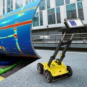
Leica DS4000 Utility Detection Radar
More Info
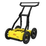
Leica DSX
More Info
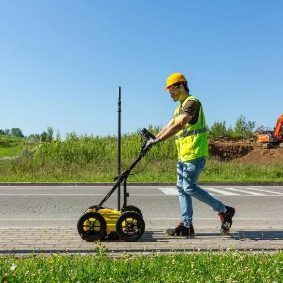
Leica DS2000 GPR
More Info
Enquire Now
Ex-Rental Ground Penetrating Radar
More Info
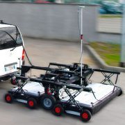
IDS Stream DP
More Info
Stream EM
More Info
Stream X
More Info
IDS Stream UP
More Info
Product Enquiry
Name
This field is for validation purposes and should be left unchanged.
Name
*
First
Last
Email
*
Mobile Phone Number
*
Region
*
Northland
North Auckland
West Auckland
Central Auckland
East Auckland
South Auckland
Waikato
Bay of Plenty
Gisborne
Hawke’s Bay
Taranaki
Manawatu-Whanganui
Wellington
Tasman
Marlborough
West Coast
Canterbury
Otago
Central Otago
Southland
Overseas
Product you wish to enquire about
*
This field is hidden when viewing the form
Category Reference
Message
CLOSE