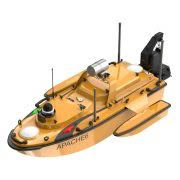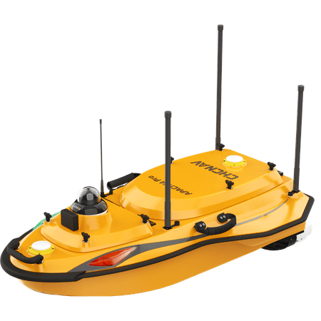
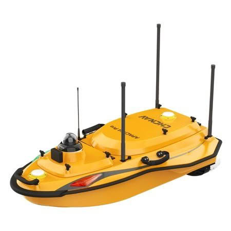
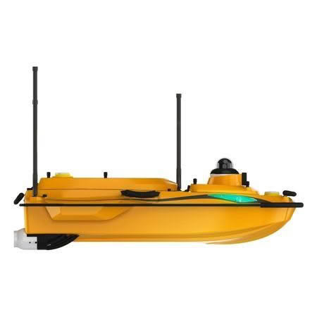
The APACHE 4 Pro is a compact Unmanned Surface Vessel designed to support most ADCP systems, with a standard single‑beam sounder and optional multibeam capability. Its shallow draft, precise navigation and stable hovering make it ideal for accurate flow‑velocity and discharge measurements, especially where launching a manned boat is difficult or unsafe.
It combines high‑accuracy positioning with automated navigation, using adaptive flow‑tracking and a GNSS+IMU module to maintain reliable heading even in obstructed environments. The system delivers high‑quality hydrographic data in challenging locations such as dam fronts or during flood conditions, while remaining easy to transport, deploy and operate.
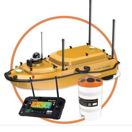
High Precision Multi Purpose ADCP
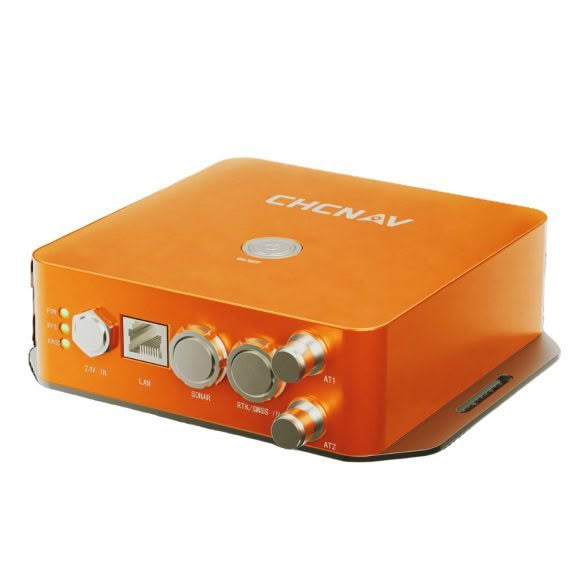
The RiverStar 3600D ADCP delivers high accuracy in both shallow and deep water environments. With a 9-beam configuration and a 600 kHz central depth measurement, it performs reliably across a wide range of water conditions, from slow to fast currents and varying depths. When integrated with the CHCNAV APACHE 4Pro USV, it streamlines operations by requiring only one vessel and one remote controller, enhancing efficiency in hydrological surveying.
Advanced navigation controller
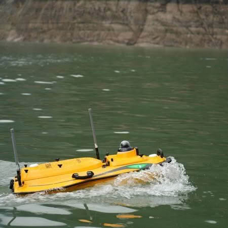
Integrated adaptive water flow straight-line and hovering technology
The autonomous control system enables APACHE 4 to navigate straight along the cross-section according to the profile view when the flow rate, turbulence, etc. changes. The hovering technology can make APACHE 4 Pro hover stably in the turbulent flow at the start and end points of ADCP observation, thereby improving the accuracy of flow estimation.
Compatible with common ADCPS
Versatile. Carries up to 35 kg of payload
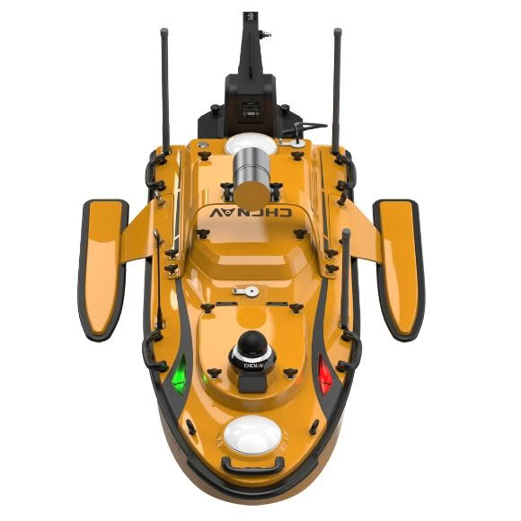
The APACHE 4 Pro central access shaft design provides unmanned cross-sectional flow measurement solutions for the leading ADCPs on the market. The APACHE 4 Pro is particularly suited for hydrologists who are looking for an integrated, portable, and affordable unmanned solution. It does not only carry the ADCP but also provides its positioning, orientation, power, waterproofing, network and 4G transmission solutions.
Built-in single beam echo sounder
Expand your unmanned survey capability
Single beam sounding data can be used to verify the accuracy of ADCP bottom tracking data and even fed directly into the ADCP flow measurement software to compensate for the unavailability of ADCP data, and at the same time, provides water depth profile data associated with the flow velocity profile measurement.
Smart positioning and navigation
Uninterrupted positioning with GNSS+IMU
APACHE 4 Pro provides a stable position and heading to the ADCP and autopilot. Its IMU sensor ensures the availability of position data even during momentary GNSS signal loss. The obstacle avoidance radar system and live video feed ensure safe operations in case of loss of visibility or difficult environmental conditions. Completely autonomous, the APACHE 4 is safely operated from the shore. The AutoPlanner and HydroSurvey software suite allows the operator to define the entire mission, from the survey area to the export of the results.