
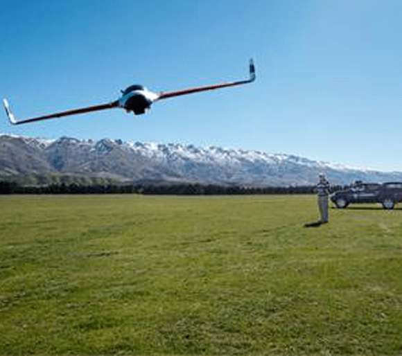
Landpro provide a broad spectrum of surveying services from subdivisions, boundary definitions, irrigation concepts, and dam designs to engineering surveys. Landpro have an excellent understanding of the opportunities and challenges in its competitive environment and has made strategic decisions to add value for its customers. One of the recent decisions was to purchase the Topodrone 100 from Global Survey.
“The Topodrone has revolutionised the way that we as a company can now service the rural and mining sector. The introduction of the Topodrone 100 has enabled us to provide our clients with highly accurate terrain and aerial imagery data and in most cases at a cost of less than a conventional ground based GPS survey,” explains Director Technical Services Mike Borthwick from Landpro.
Topodrone is a unique and true photogrammetric mapping UAV systems, using a Direct Georeferencing solution. The difference and, at the same time, the main advantage of the Direct Georeferencing Solution is that it encompasses Post Processed Kinematic (PPK) principles. An important component of PPK is a high accurate GPS receiver on board of the Topodrone which independently logs the GPS coordinates of the drone for each and every photo position.
“The Topodrone manufacturers went this way because Real Time Kinematic (RTK) has radio-link issues and distance issues. It is limited to the telemetry range and other radio frequency interferences (terrain, vegetation, buildings, atmospheric conditions, etc). RTK accuracy reduces as distance increases. If loss of radio frequency or telemetry during the flight happens – you have missing data which will compromise the accuracy of the whole flight run”, explains Bruce Robinson Director at Global Survey
The ease of use of the system enables Landpro operators to redefine the survey area on the fly. This ensures that all areas needed to be covered can be flown without the need for hours of preplanning in the office.
“The photogrammetry from our accurate system allows point cloud information being acquired down to 2 centimetre on ground pixels,” says Mike. “Nothing gets missed and everything on-site can be pin pointed in the imagery.”
Landpro can achieve great results due to the fact that its UAV is a true photogrammetric mapping system which addresses geometric errors (tip, tilt, yaw, forward and lateral motion, blur) from the start and eliminates them right at the point of capturing the data. So far, no other manufacturer of drones has claimed such an accuracy, neither relative, nor absolute.
“The foresight from Global Survey to bring this product to New Zealand, solved the hard issue for us as to, which product to purchase,” says Mike. “The accuracy achieved by the Topodrone far exceeds any other UAV on the market, which backed by Global Surveys support and service made our board’s decision to become the first customer in New Zealand a given.”
Aerial mapping no longer needs to be time-consuming, nor expensive and certainly should be readily available. Landpro have dramatically increased the productivity, data reliability and reduced the costs for their customers.
“The demand for the use of the drone as a surveying and mapping tool is exceeding the number of flyable days due to weather restraints, so for us it won’t be long before we look at obtaining a second unit to meet demand,” explains the Director Technical Services Mike Borthwick from Landpro.