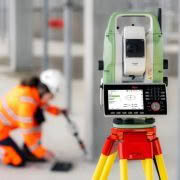
Engineering companies and contractors face increased challenges monitoring this change. They are being charged with – and being held liable for – the condition of the structures they create and maintain. In order to surmount these challenges, engineers need to be able to measure structural movements to millimetre-level accuracy. For equipment to manage and monitor these structures, engineers rely on Leica Geosystems and the Leica Nova TM50 Monitoring Station: because every half second counts!
“We have a fleet of 8 Leica Total Stations and we chose them are they’re so fast and reliable. Leica is the brand we can turn to for cutting-edge surveying.”
Mark Finlayson, Survey Director, Envivo
| IMAGE ASSISTANCE FOR EVERY SITUATION | CONTINUOUS OPERATION AND RELIABILITY | COMPLETE MONITORING INTEGRATION |
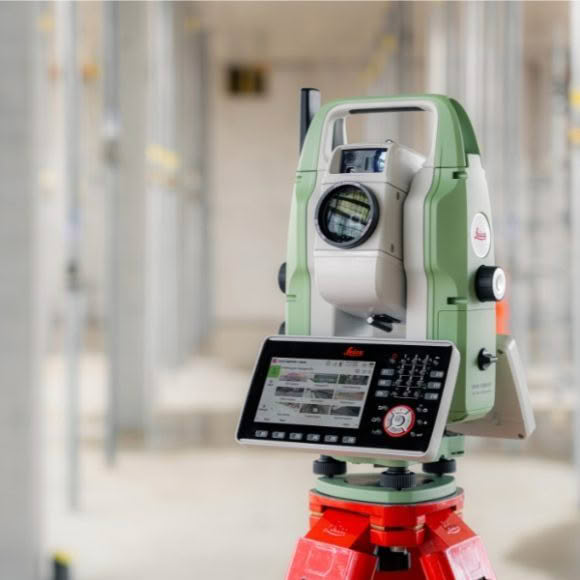
| The Leica Nova TM50 includes an overview camera and a telescope camera with 30x magnifi cation and autofocus. With state-of-the-art image processing technology the Leica Nova TM50 delivers the highest quality image for complete visual documentation of the monitoring environment. Obstructions in the line of sight can be easily inspected remotely, avoiding safety concerns in high risk environments. | The Leica Nova TM50 meets the challenge of 24 hours, 7 days a week monitoring applications. It is designed to withstand the roughest use in the most severe environments. The Leica Nova TM50 will operate throughout a wide temperature range and is protected against wind driven rain, sand and dust. The Leica Nova TM50 is fully operational in bright sunlight and complete darkness. | The Leica Nova TM50 forms one component of a unique Monitoring solution which seamlessly integrates total stations, GNSS receivers and antennas, geotechnical sensors, software and IT communication infrastructures. Leica GeoMoS software provides a highly flexible automatic deformation monitoring system that is able to combine sensors to give you peace of mind |

| HIGHEST MEASUREMENT ACCURACY | FLEXIBLE CONNECTIVITY |
|
|
| ROBUST IP65 DESIGN | POWER MANAGEMENT |
|
|
| HIGH RESOLUTION OVERVIEW AND TELESCOPE CAMERA |
HIGH DYNAMIC PIEZO DRIVES |
|
|
| Facilitating important decision making
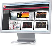
Leica GeoMoS software provides a highly flexible automatic deformation monitoring system that is able to combine geodetic, geotechnical and meteorological sensors to match the needs of your monitoring project, whether it is large or small, temporary or permanent. With the addition of the GeoMoS Web service, visualisation and analysis of monitoring data can be performed anywhere and anytime using a web browser, mobile phone or tablet. Make important decisions with Leica GeoMoS. |
 |
Download the Leica Nova TM50 Brochure
![]()
Download the Leica Nova TM50 Datasheet
![]()