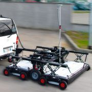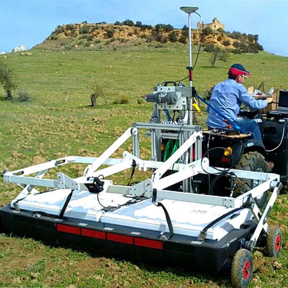
Stream X is a vehicle-towed ground penetrating radar solution with an array that covers a 2m wide swath with a single pass for extensive underground 3D mapping.
To achieve complete coverage of the survey area, multiple passes can be controlled through sophisticated positioning systems and a dedicated navigation software. Once the desired area is covered, the survey can be easily checked and then post processed with a dedicated IDS software platform.
Stream X is the ideal solution for 3D mapping of:
- Extensive archaeological sites
- Detection of underground structures
- Cavity identification and mapping
- Underground tank detection
- Area clearance prior to construction
Stream X Key Features:
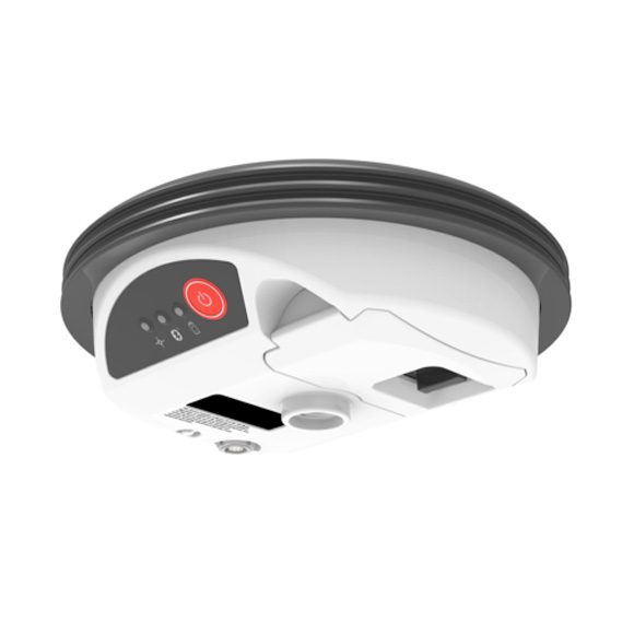
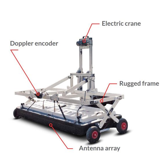
- Massive array of antennas: Stream X can be equipped with three different array configurations from 16 to 48 channels. A three times the closest spacing on the market, antenna spacing in the Stream X can be as little as 4 cm.
- Different frequencies (200 MHz or 600MHz): Stream X can be equipped with a 16 channel 200 MHz array in order to achieve the best penetration. Maximise resolution with a 24 – 48 channel 600 MHz array.
- Mechanical frame: A solid mechanical frame which has been tested in several rough terrain conditions and harsh environments.
- 3D tomography: The most defined underground 3D model currently available.
Benefits of the Stream X:
- Cost reductions in underground investigation procedures while also providing more information on what is buried underground;
- Increased performance: Able to detect the presence and shape of anomalies present in the soil;
- Fast and accurate survey even in rough terrain;
- High productivity: up to 1 hectare/hour and a dedicated post processing platform;
- Highest data resolution with an antenna spacing as low as 4 cm
Real time software for advanced viewing
Stream C is supplied with the OneVision and GRED HD 3D CAD software suites.
OneVision
OneVision – Acquisition software for use in the field. Providing real-time target viewing, onsite object mapping and GPS navigation, OneVision is a software application for advanced GPR data collection This powerful tool can be used with an array of antennas when performing utility mapping, archeological and environmental surveys, and extensive mapping of medium to large size projects.OneVision is available for:
- Stream EM
- Stream X
- RIS MF Hi-Mod
OneVision is a powerful application for advanced surveys with integrated navigation, featuring:
- Real-time tomography on a cartographic background (e.g. Google Maps, GeoTIFF and KML)
- Multi-view screen with GPR radar maps (B-scan and T-scan), radar tomography (C scan) and cartography
- Survey planning tools
- Special function allowing tomographic merging of transversal and longitudinal swathes
- Continuous monitoring of GPR and GPS statuses
- Survey management with interactive and on-site target mapping as well as review and editing
- Automatic Pipe Detection (optional)
OneVision provides increased productivity and reduced costs. Other benefits include:
- Immediate decision-making with real-time on-site detection
- Target recognition removing the need for specialist skills
- Immediate understanding of complex environments (e.g., urban areas) with the tomographic map in real time
- Complete coverage is always provided in a single visit with integrated acquisition and navigation functions
GRED HD 3D CAD – specialised integration software
Specifically designed to offer an integrated framework for CAD and GIS, GRED HD 3D CAD combines the characteristics of industrial productivity with high levels of reliability.
The software offers the fast creation and display of 2D and 3D tomograms in just a few minutes after basic filtering. Raw data, structures and objects of any generic shape are able to be directly exported to CAD or GIS maps.The software is fully compatible with any GPS or positioning data in order to obtain automatically geo-referenced data plots.
Key features include:
- Real-time display of trajectories using GPS or Total Station.
- 2D and 3D tomography for an immediate visualisation and detection of anomalies.
- Automated transfer to CAD/GIS: the identified target can be automatically transferred to CAD or GIS maps for professional SUE / utility mapping.
- Geolocated data information and visualisation