
Latitude Surveying started in 2003 and is a multidisciplinary consultancy offering cadastral surveying, land development, construction support and topographic survey services. With the investment in Leica Captivate solutions, Latitude has the platform to extend their capabilities to terrestrial photogrammetry and BIM.
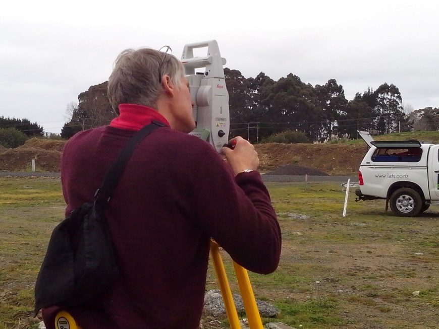
With New Zealand becoming increasingly complex every day and the growing need for better infrastructure, now more than ever before we need to capture, digitalise and visualise infrastructure projects quickly, easily and accurately. That is why Trevor Davey, Licensed Cadastral Surveyor at Latitude Surveying, adopted the new Leica Captivate solution to meet these growing needs.
Leica Captivate is industry-revolutionising software for a variety of measurement instruments, including MultiStations and total stations, that creates the most realistic 3D renderings with familiar apps and easy-to-use touch technology.
The future of surveying is Leica Captivate; it is the survey industries only touch-technology software with the world’s first self-learning total station, which brings live-streamed intelligent cloud-based imagery into the field.
“After purchasing Leica Captivate TS16 Robotic, a CS20 Controller and a GS14 GNSS our projects run faster and we are more efficient. The Captivate range and robotics give us a platform to complete any survey task, and ensures we are recession proof by allowing us to provide BIM services in the future,” says Trevor Davey, Licensed Cadastral Surveyor, Latitude Surveying.
For Latitude adopting Leica Captivate robotics and software technologies has meant they can provide clients with fast and accurate data realisation for a diverse array of projects. It means they can avoid costly returns to site, and save time and effort for clients. Latitude can now make better decisions on site by comparing virtual design data with real work conditions and increase efficiency by assuring the quality of our work in 3D directly in the field.
“We can now visually check on site the completeness of our job, ensuring that we have captured all the data we need and avoided costly returns to the site, this saves our clients significant costs.”
“As a smaller company, it has definitely been worth our investment in this new Leica robotic system. The Captivate platform allows us to step outside of our traditional cadastral surveying and offer clients additional services. The Leica TS16 is extraordinarily intuitive and quick, has a colour touchscreen and is very easy for one surveyor to use in the field.”
“The high quality of our Leica equipment ensures we produce the very best result for our clients. And Global Survey offers us experienced professional after sales support for our Leica technology,” says Trevor.