
Faster Outdoor Reality Capture with Scan & Go
Categories:
Tags:
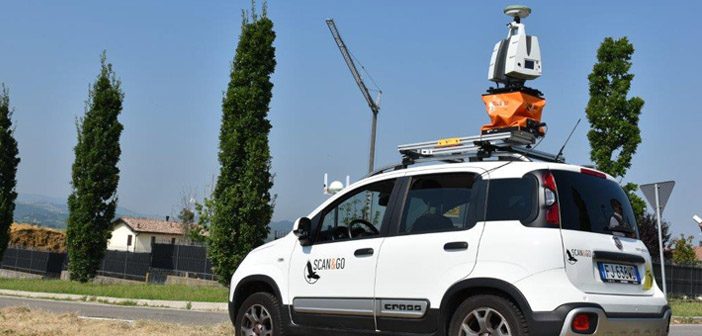
The Scan & Go system is a vehicle-mounted, elevated platform for outdoor laser scanning projects. It is self-leveling, compatible with all makes and models of laser scanners and easily mounted on top of any vehicle.
With a growing demand for large volumes of 3D data acquisition, the Scan & Go… Read More
Leica MC1 – One Common Platform, One Panel, Multiple Machines
Categories:
Tags:
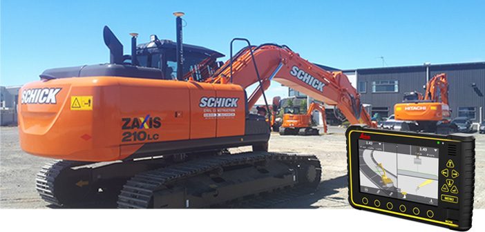
The new Leica MC1 solution consists of a state-of-the-art MCP80 control panel combined with next generation machine control software. Leica Geosystems delivers an intelligent and intuitive hardware and software combination.
Leica MC1 solution offers a unified hardware platform with common software interface, across multiple machines that integrates seamlessly with the… Read More
Leica HDS: Reality Capture Software Explained
Categories:
Tags:
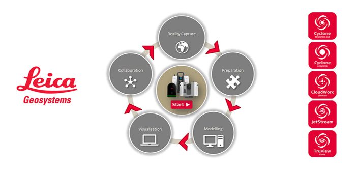
Leica Geosystems is the market-leader in point cloud delivery solutions. We offer a family of hardware and software that provides the widest set of work process options for 3D laser scanning projects in engineering, surveying, construction and related applications.
Model and share your point cloud data with end-to-end Leica HDS… Read More
New Workflows for Reality Capture Success [Webinar]
Categories:
Tags:
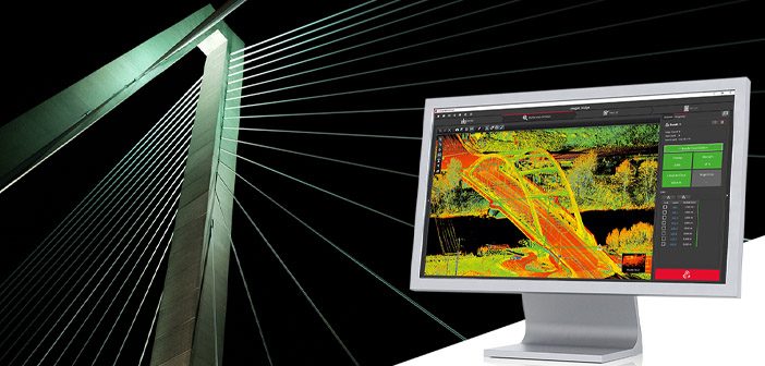
With a full range of 3D workflow solutions from the field to the office, Leica Geosystems is the ideal partner for you to enter the reality capture market. We are already supporting our customers in this digital transformation with dedicated workflows for various applications. By ensuring simplicity, accuracy, and reliability… Read More
Introducing Leica iCON iCT30 – Your New Construction Layout Tool
Categories:
Tags:
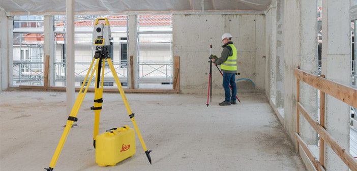
NEW Leica iCON iCT30
The new Leica iCON iCT30 is an entry-level construction layout tool built for one-person layout tasks, it’s designed to increases productivity by minimising labour time and errors, while increasing accuracy and speed.
With a measurement range of up to 80m and an angular accuracy of 9… Read More
Downer NZ Invests in Leica Mobile Mapper
Categories:
Tags:
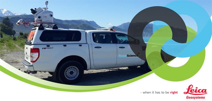
We’re pleased to announce that Downer NZ have secured New Zealand’s first Leica Pegasus: Two [Ultimate] Mobile Mapper.
The revolutionary Pegasus: Two captures spatial data using a combination of Inertial Measurement Unit [IMU], cameras, GPS and laser profiling technology delivering geo-referenced data for multiple applications.
A key benefit is the… Read More
Survey & Spatial NZ Annual Conference 2019
Categories:
Tags:

Are you attending this year’s Survey & Spatial NZ Annual Conference?
Later this week we’ll be celebrating 130 years of the association in NZ and we’re proud to have been involved for several of those decades, more recently as a Diamond Partner, actively supporting NZ Surveyors and the industry.
The… Read More