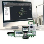
MicroSurvey STAR*NET 8 is an easy-to-use Windows application that adjusts 2D/3D survey networks using rigorous Least Squares techniques.
STAR*NET handles networks containing conventional observations combined with GPS vectors, with up to 10,000 adjustable stations. Differential leveling observations can also be included within a 3D adjustment. Whether a survey consists of a single-loop traverse or a complex network of interconnecting traverses, all observations are adjusted simultaneously to produce a single best-fit solution. STAR*NET can reduce observations to NAD27, NAD83 or UTM with separate grid factors calculated for all distances and t-T corrections calculated for all angles.
Custom Transverse Mercator and Lambert grids may be defined for special local requirements or for grid systems in most areas of the world. Angular measurements are supported in both Deg-Min-Sec and GONS.
STAR*NET comes in several editions: Lev, Standard, Plus, and Pro, plus a number of handy conversion utilities, to ensure you get precisely the tools you need.


